Historic Photos
Deal to Hythe Map (1829)
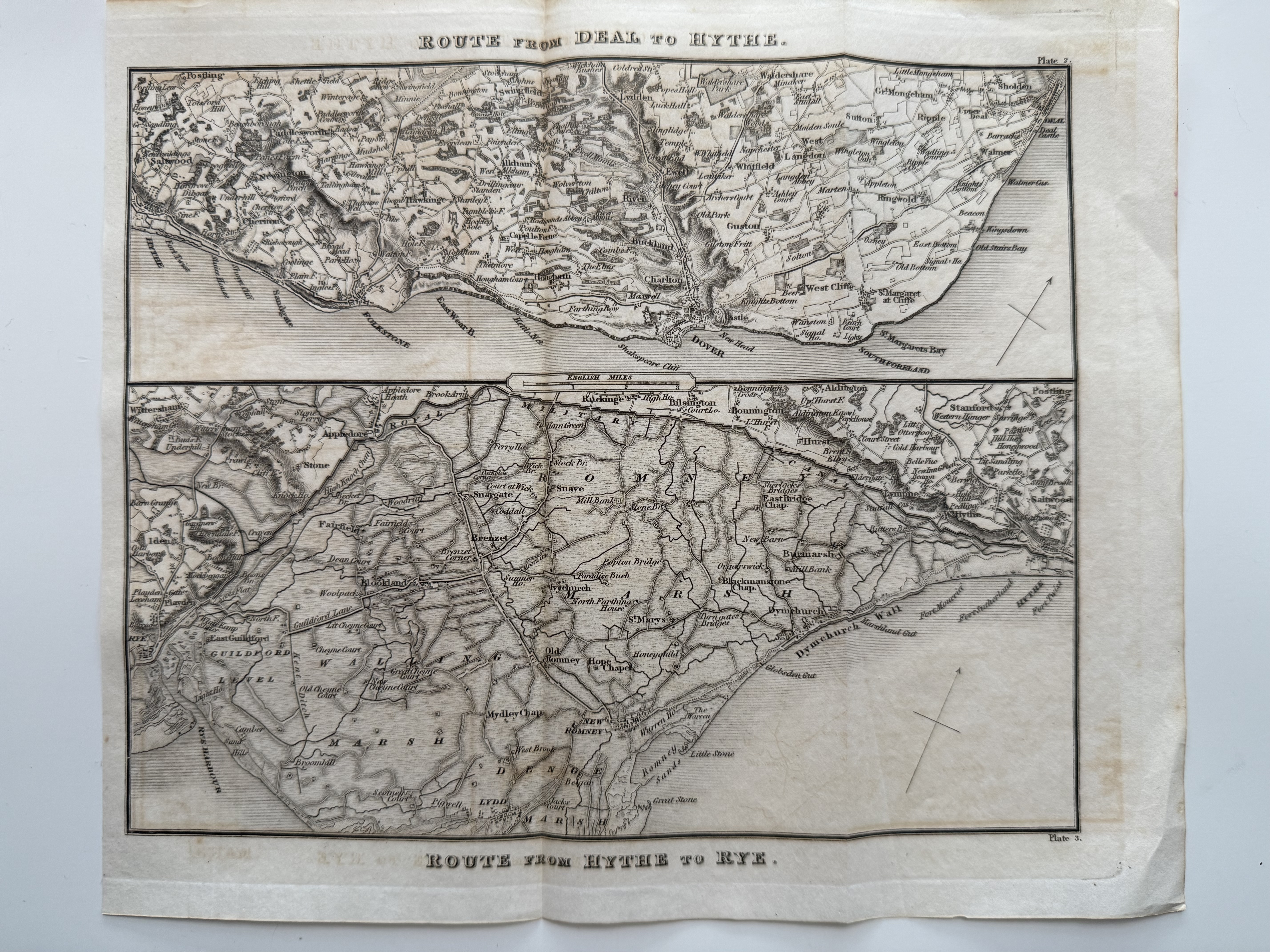
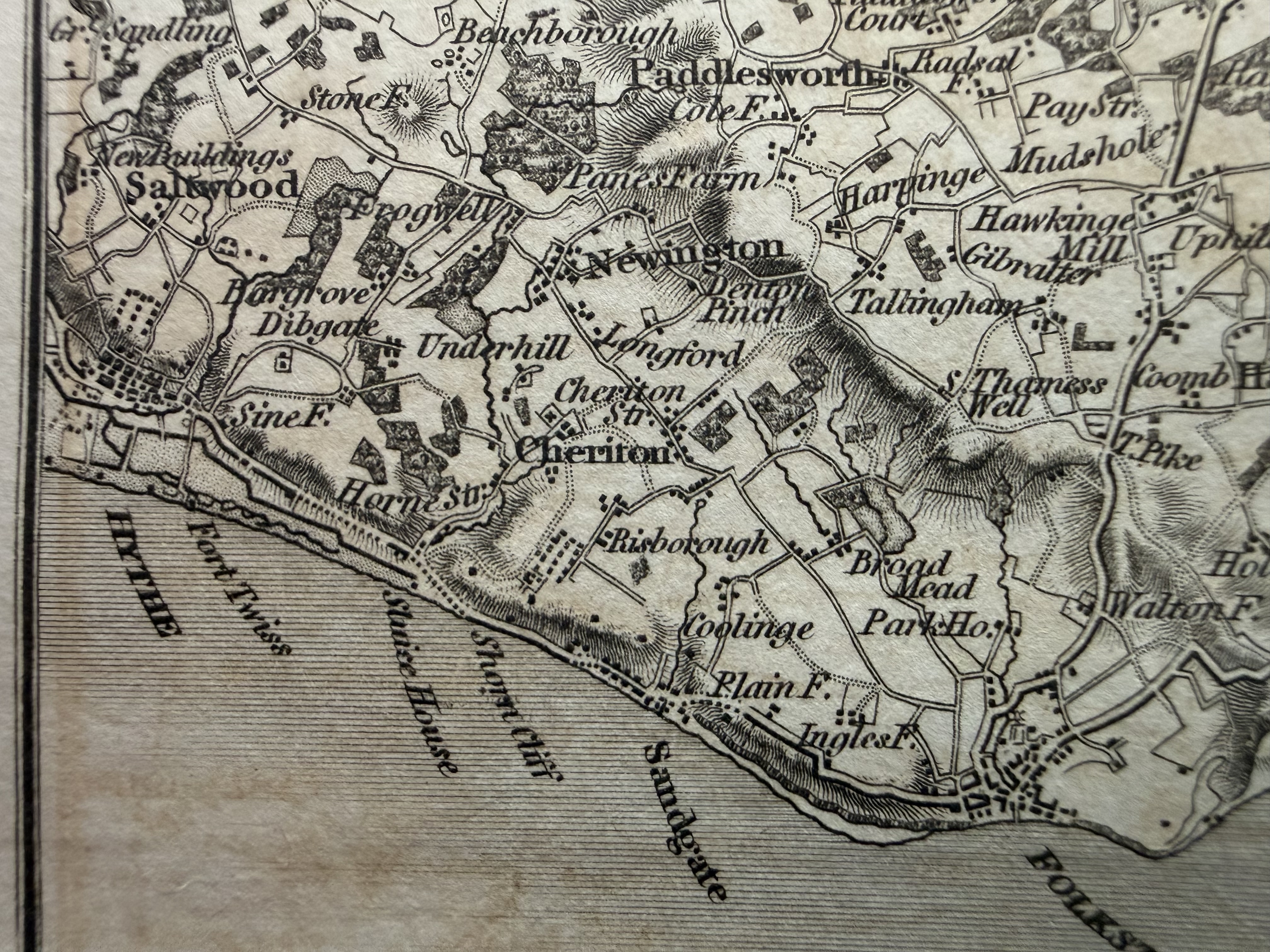
Paterson's Roads by Edward Mogg, black and white (25 × 21 cm). Held in the on-site archives.
Hythe Borough Boundary (c.1835)
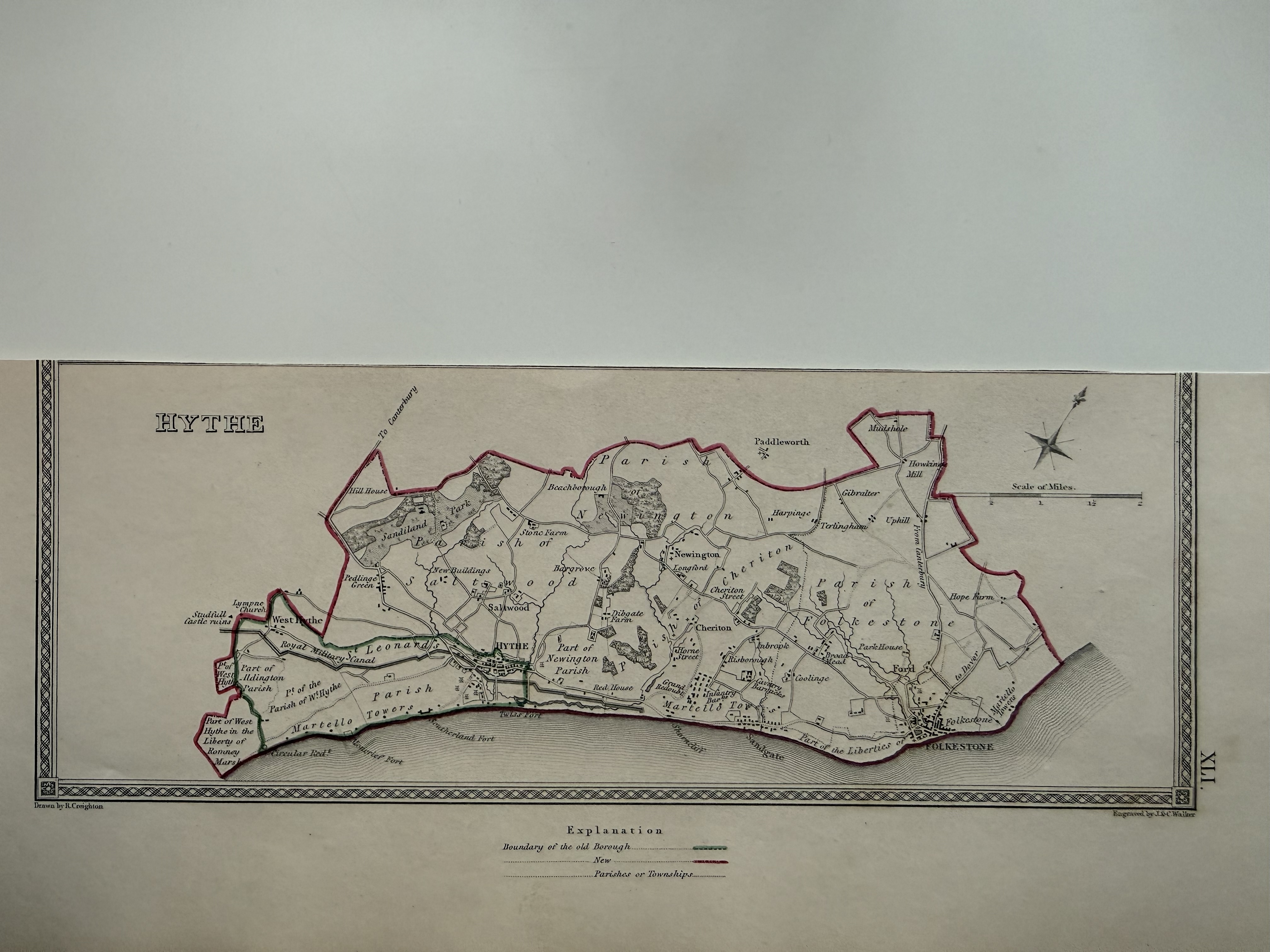
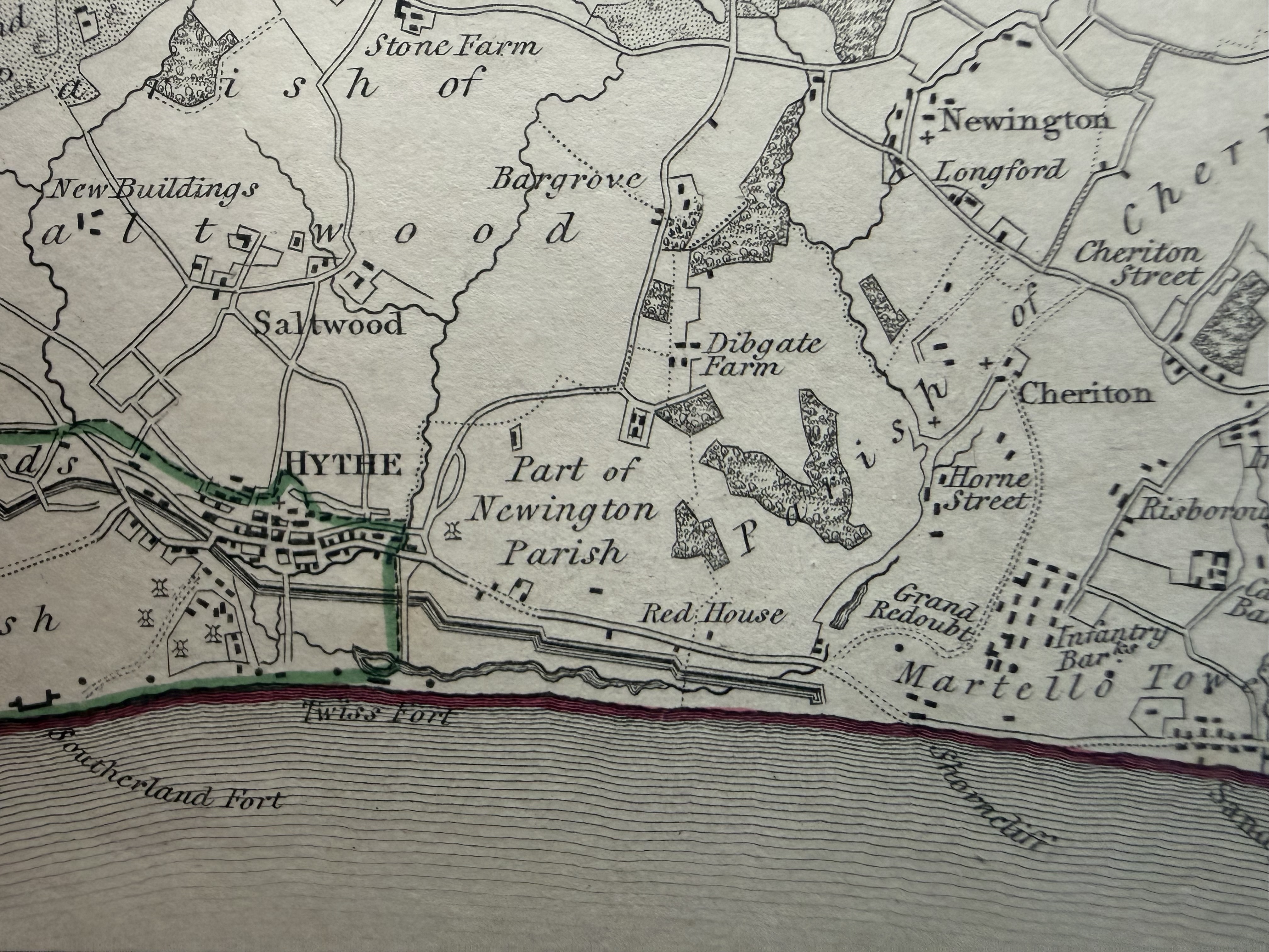
C. Lewis / Engraved by Walker. Held in the on-site archives.
Hythe, Kent Parliamentary Boundary (1868)
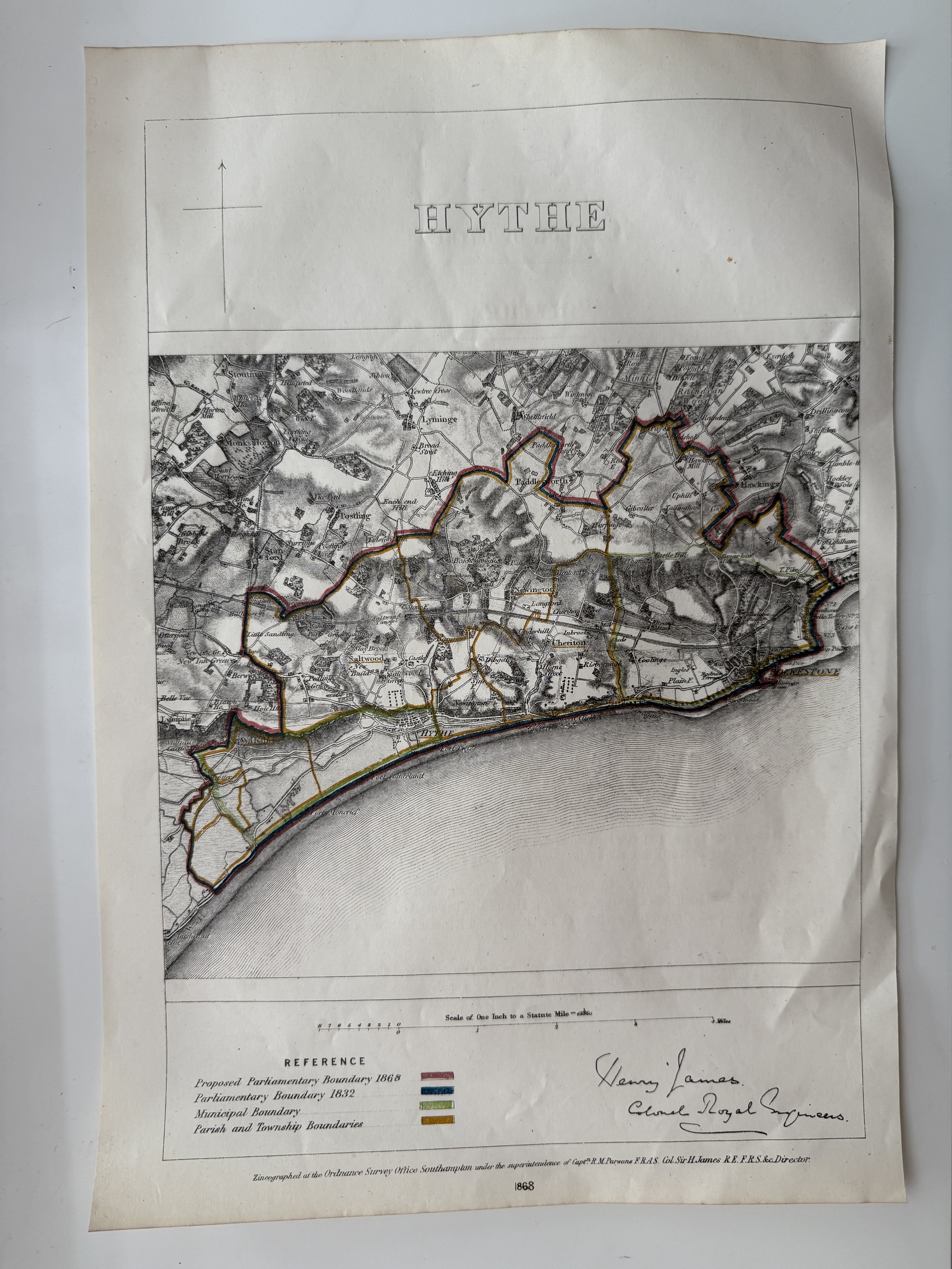
James Parliamentary Boundary Commission. Held in the on-site archives.
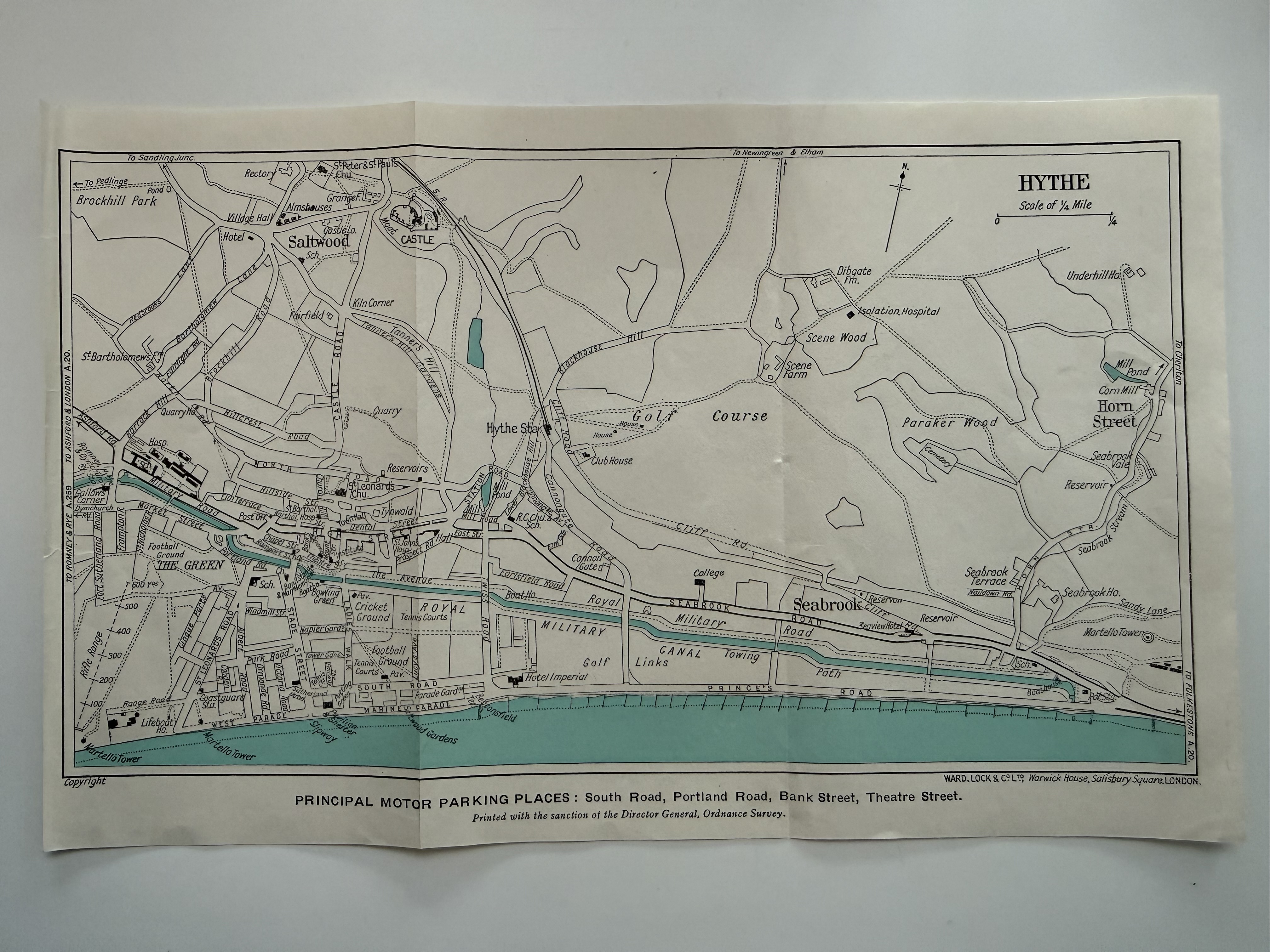
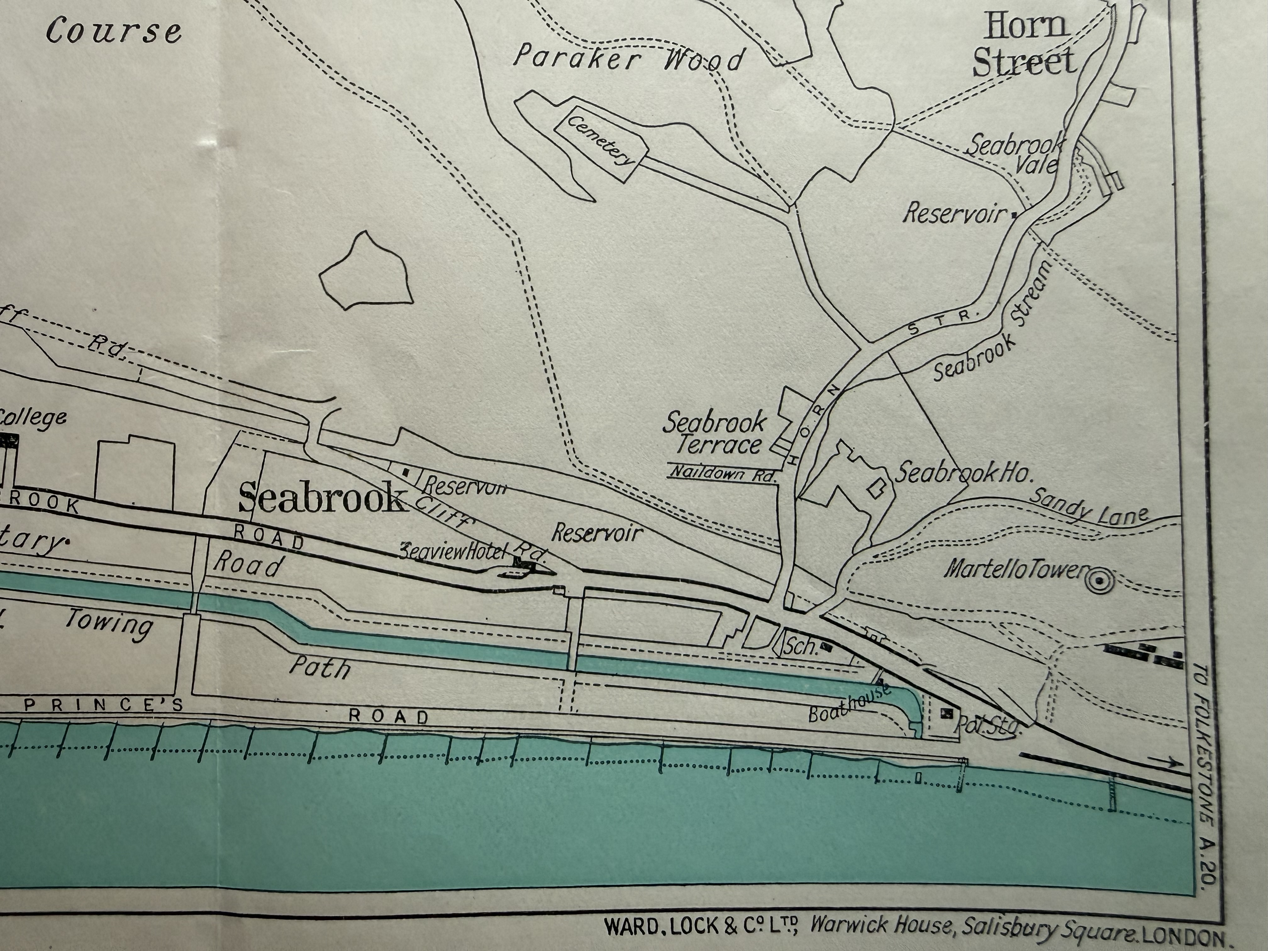
Hythe Tourist Town Map (1924)
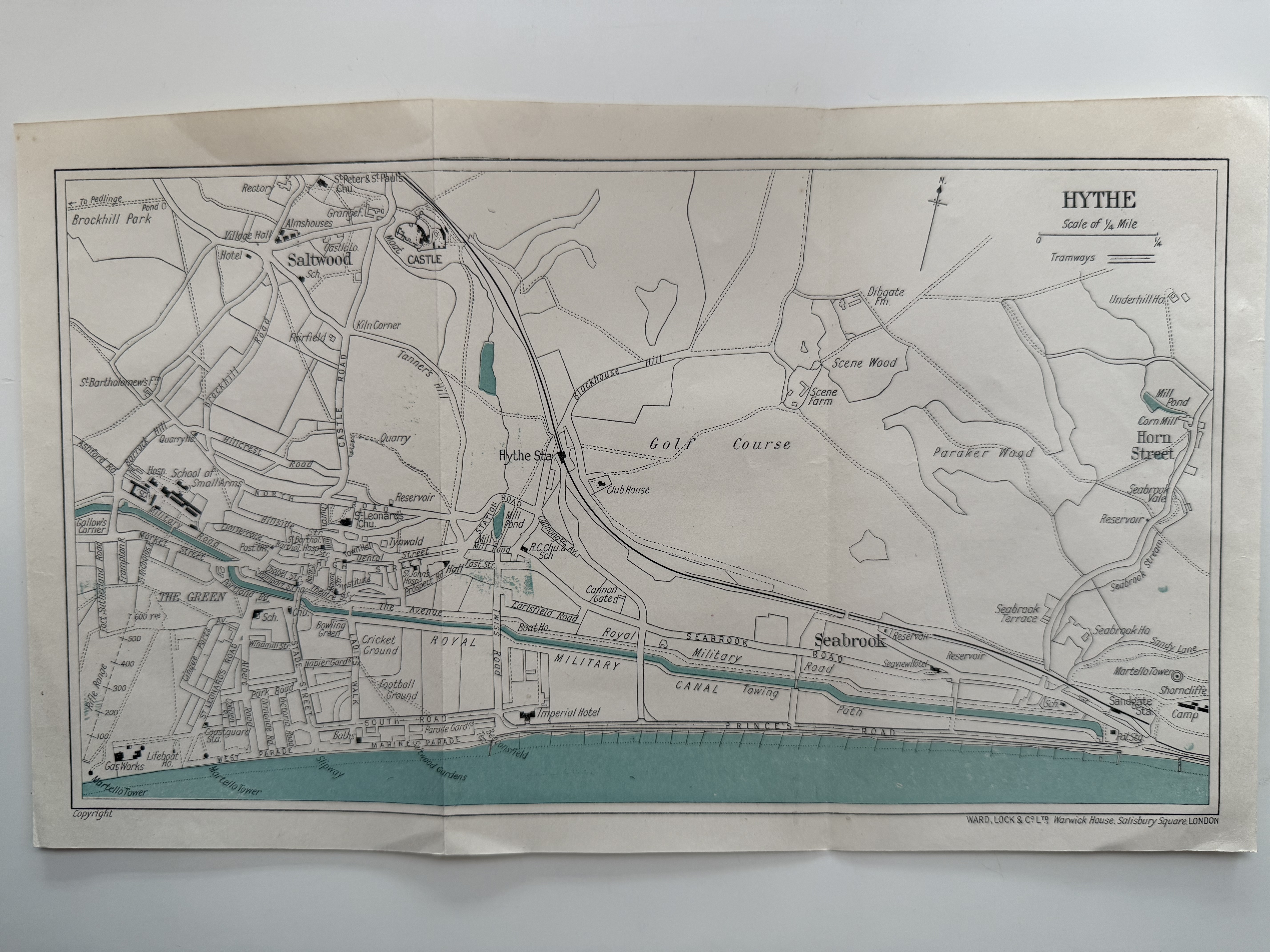
Ward Lock & Co. Held in the on-site archives.
Dungeness to Lympne Coast Profile (1943)
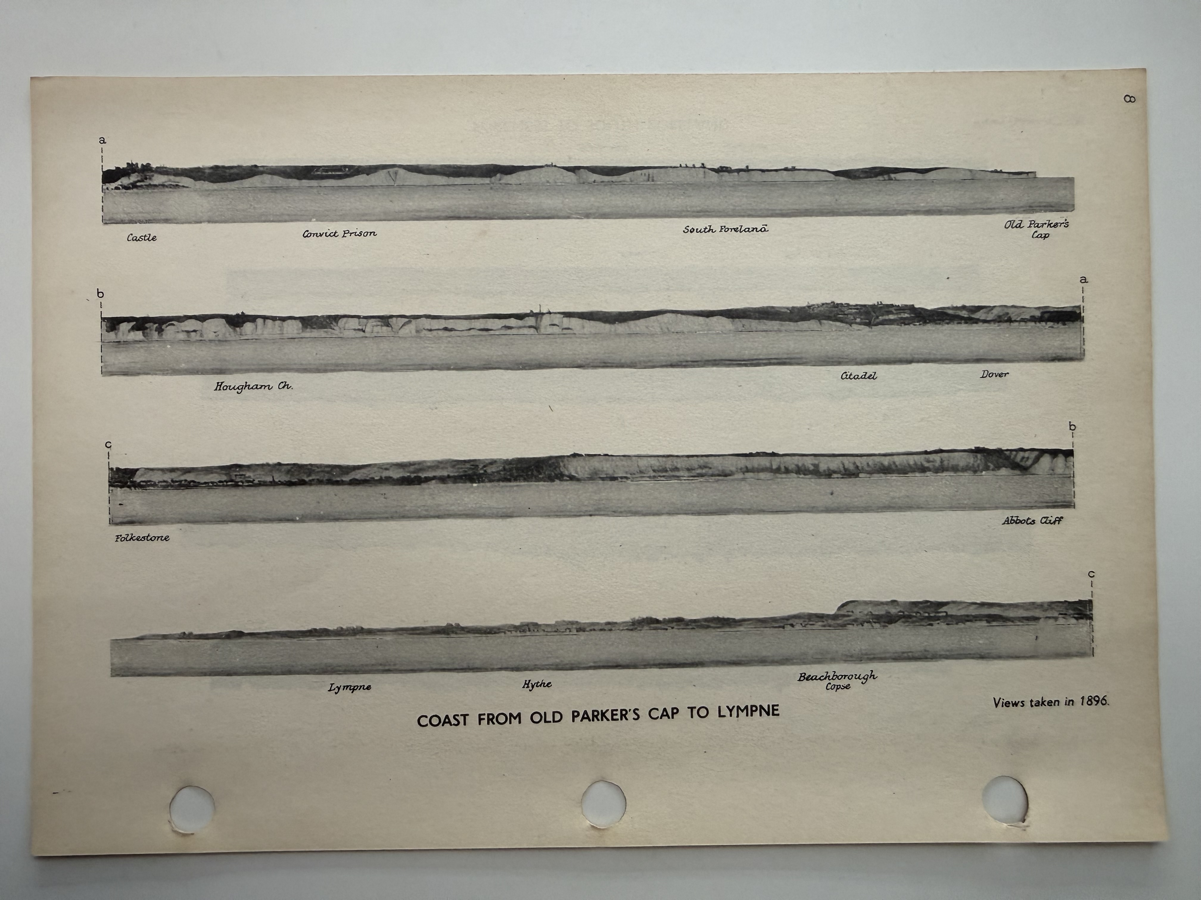
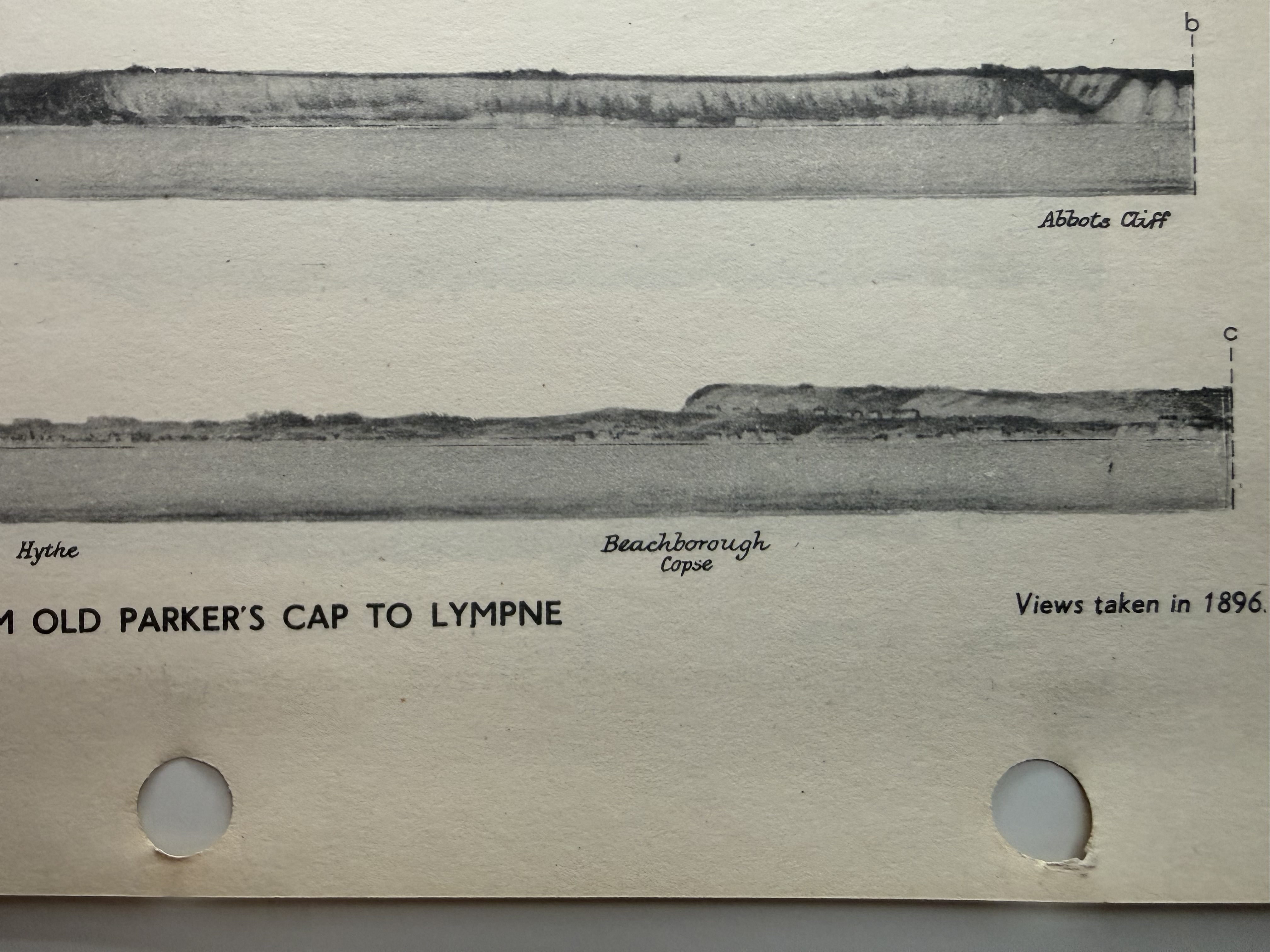
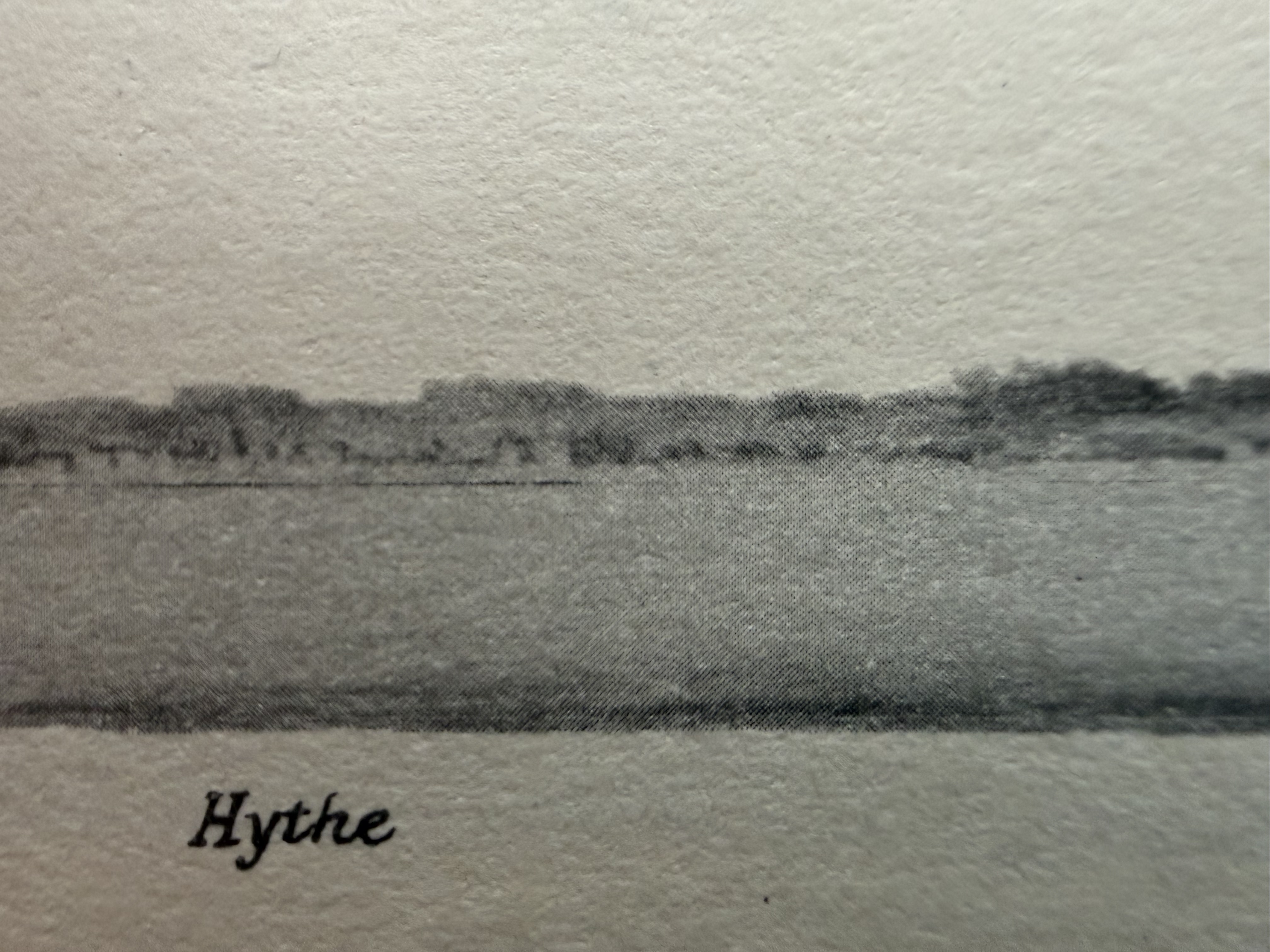
Admiralty chart. Held in the on-site archives.
Hythe, Kent (1943)
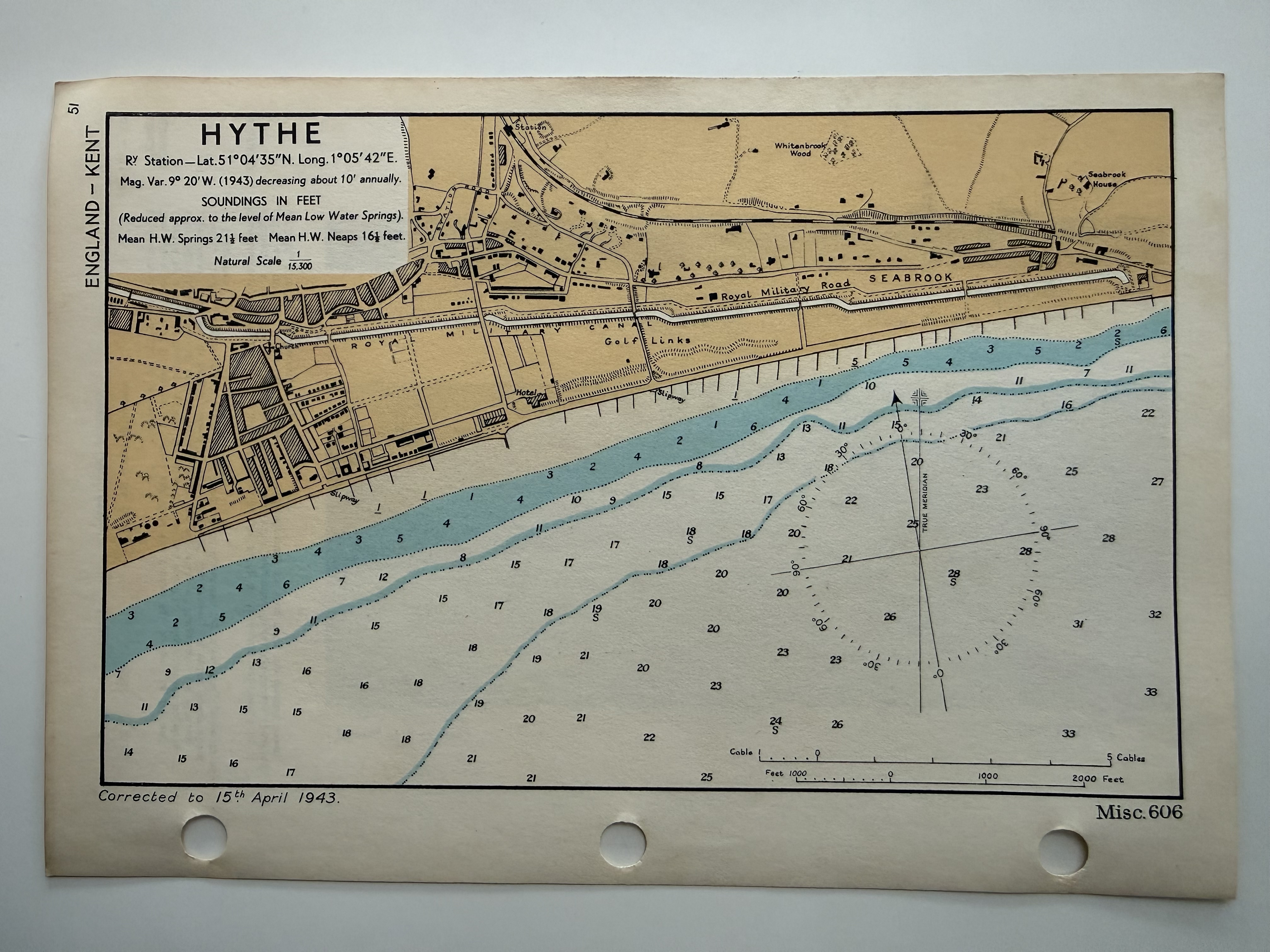
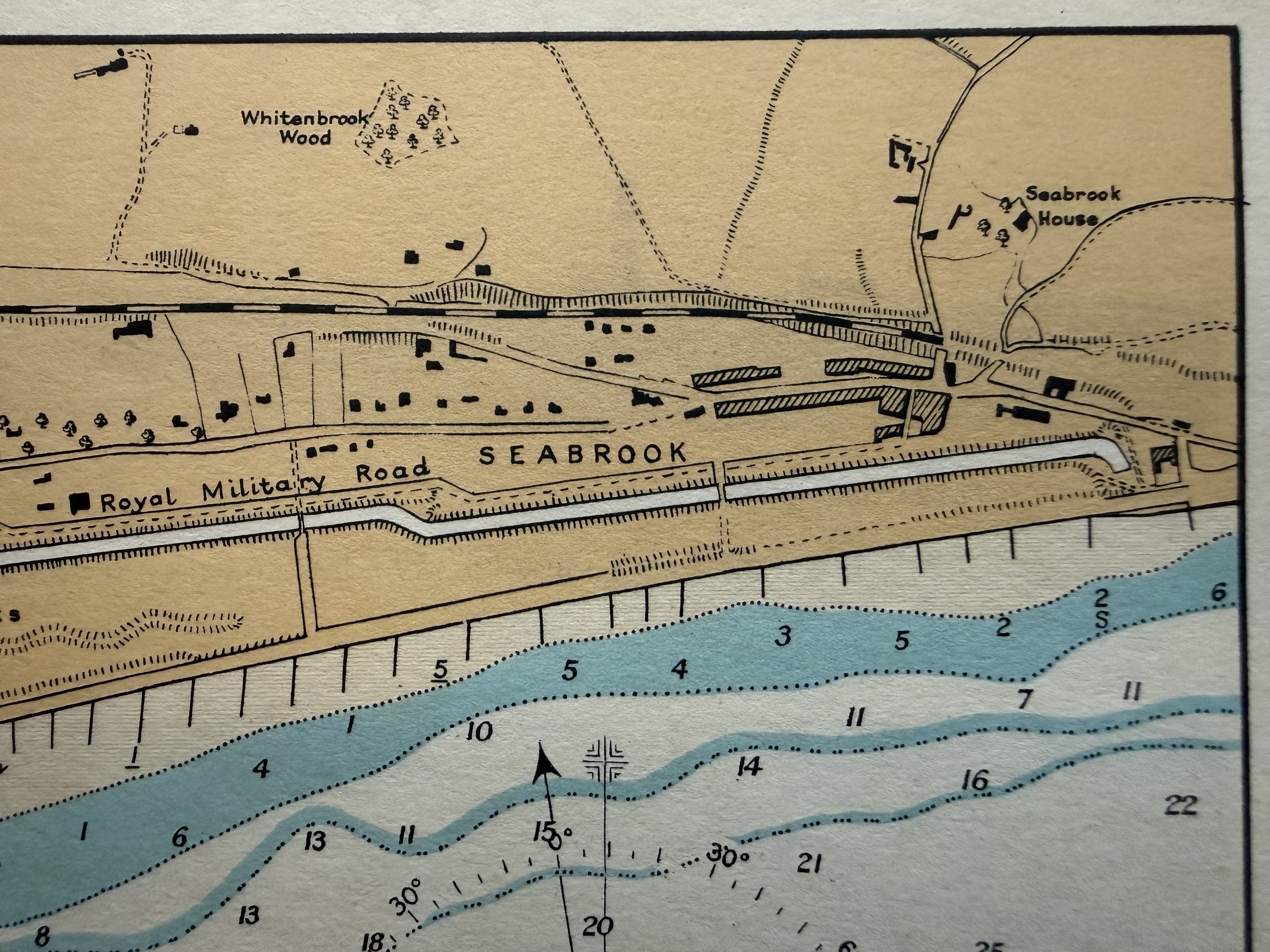
Admiralty Royal Navy map. Held in the on-site archives.
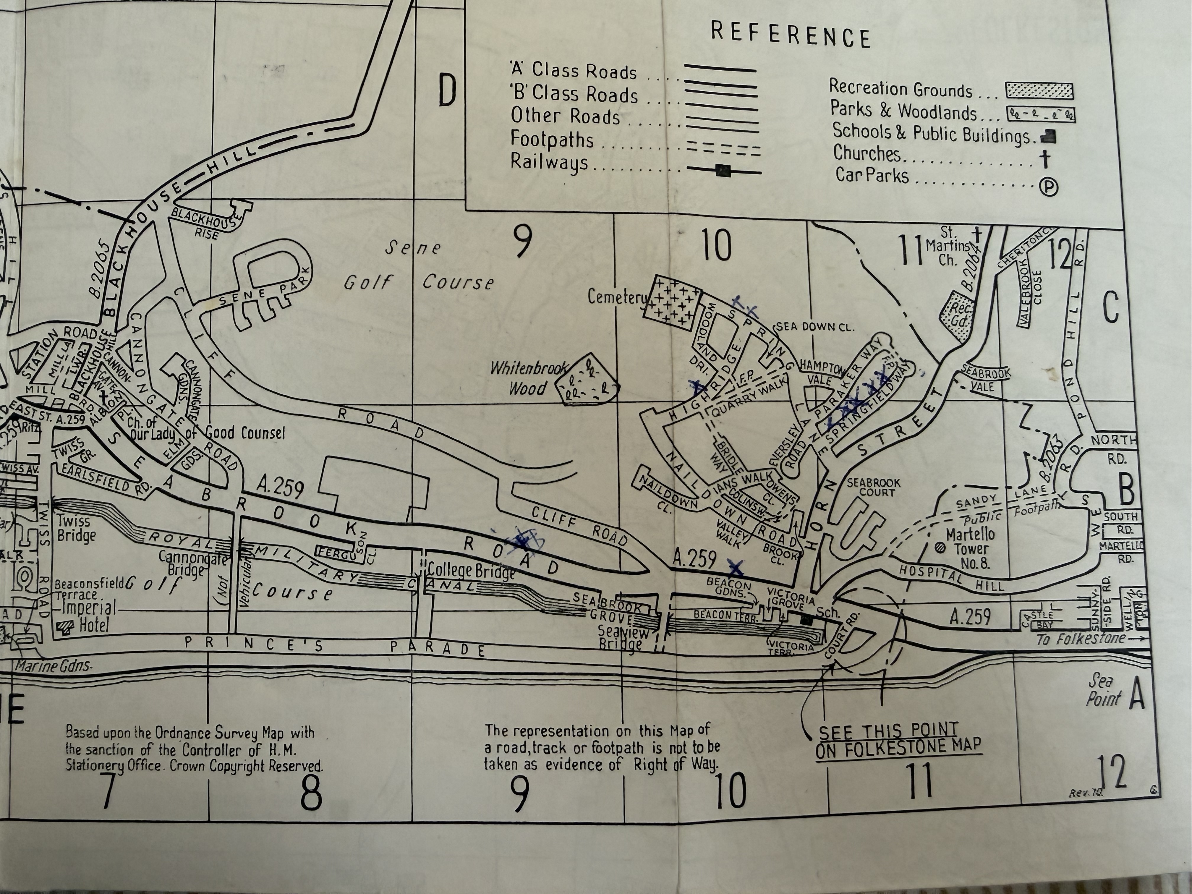
Hythe Tourist Town Map (1952)
Ward Lock & Co, showing Naildown Road. Held in the on-site archives.
Folkestone & Hythe Street Plan (1960s)
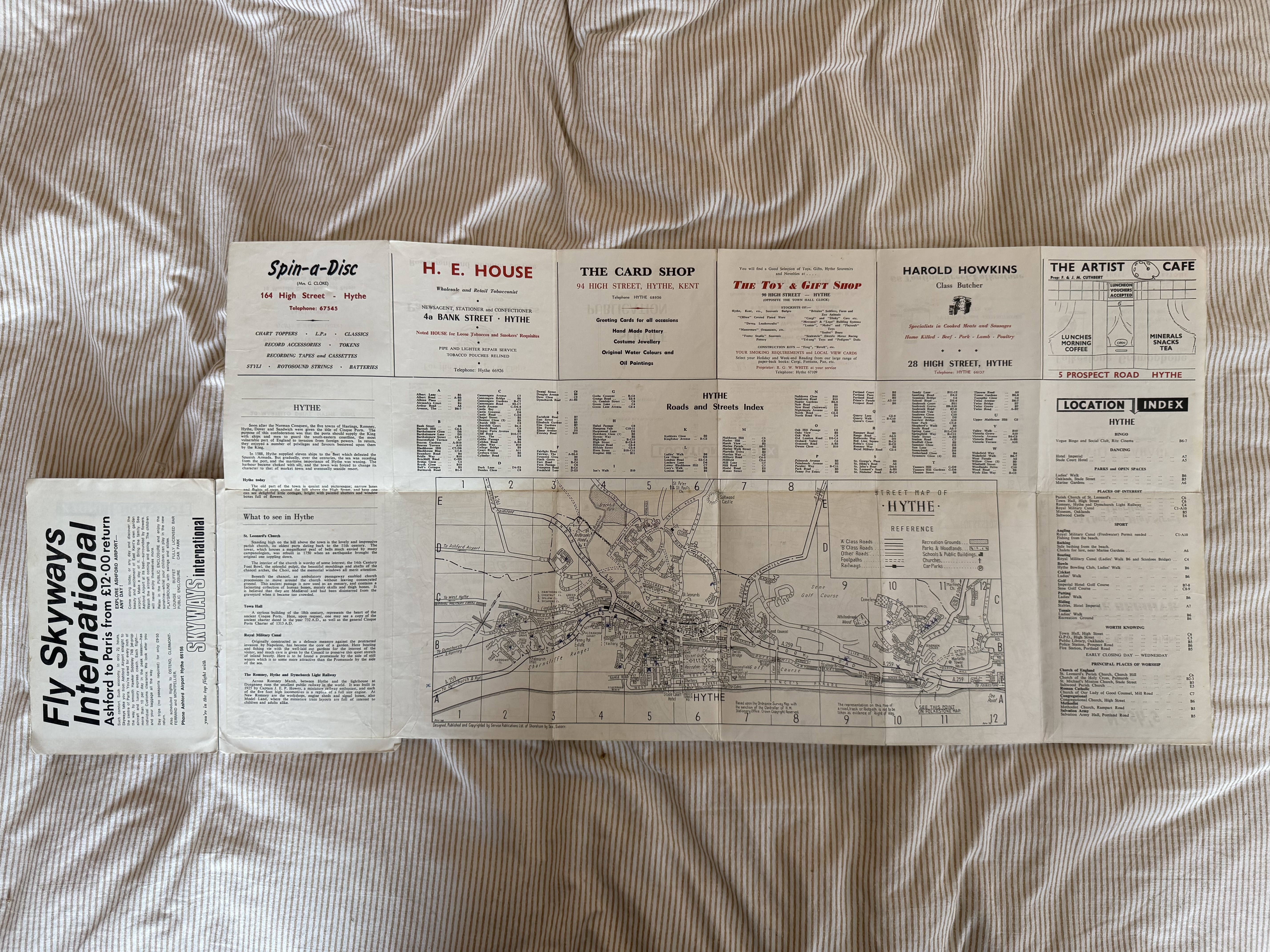
Street plan and guide. Held in the on-site archives.
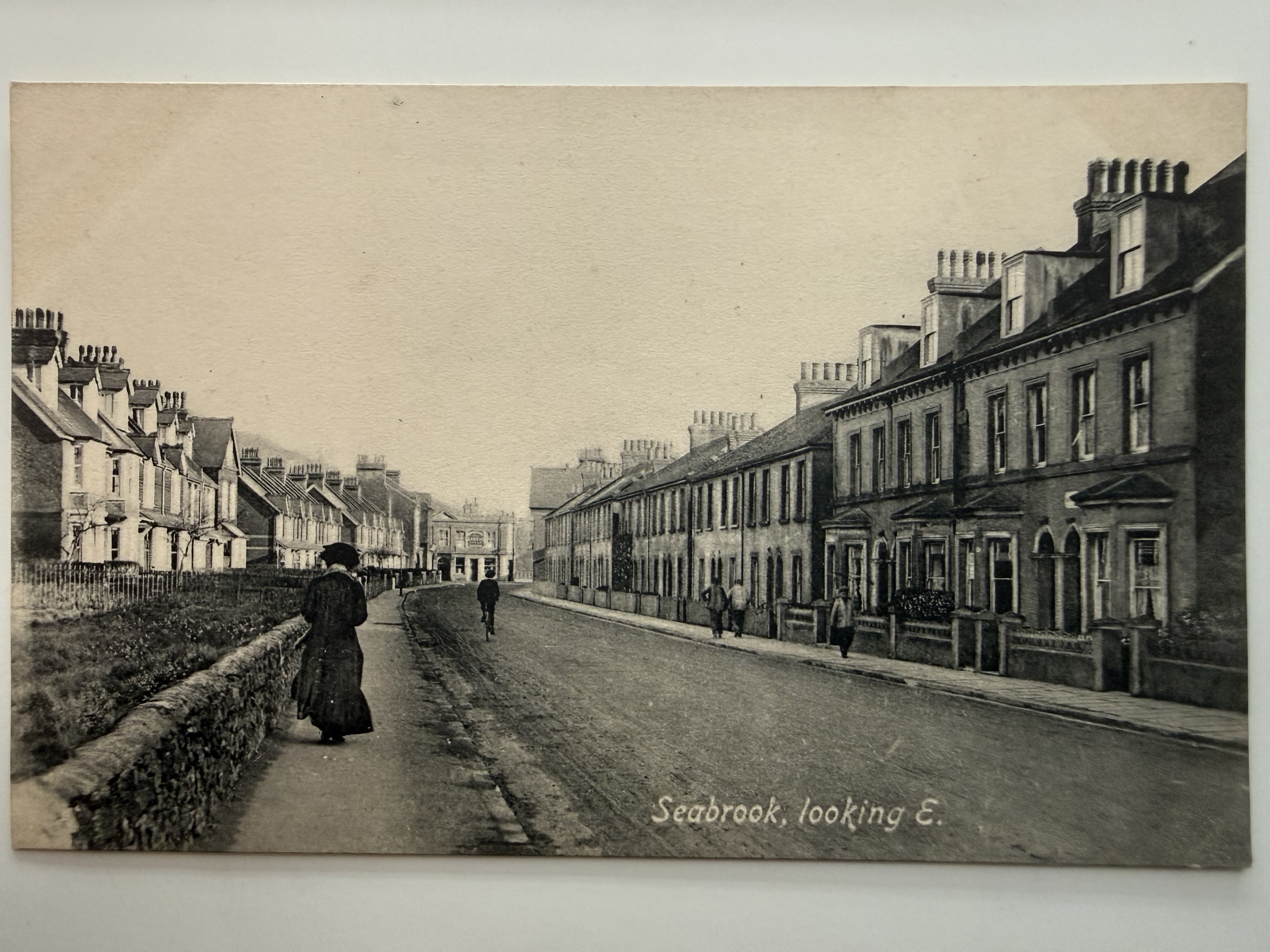
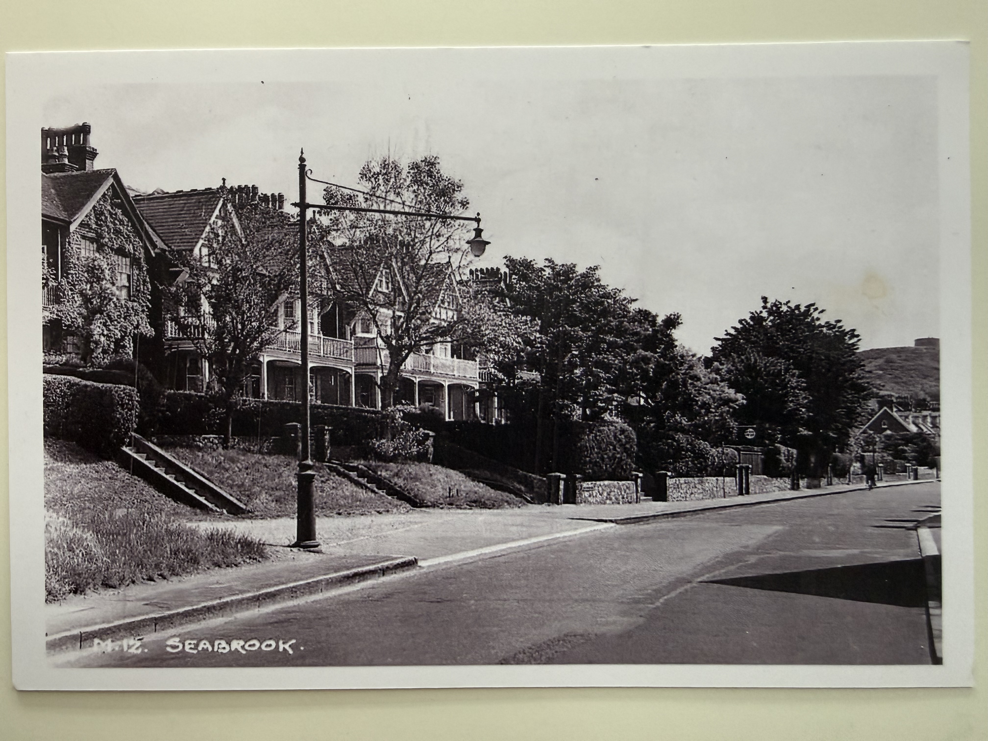
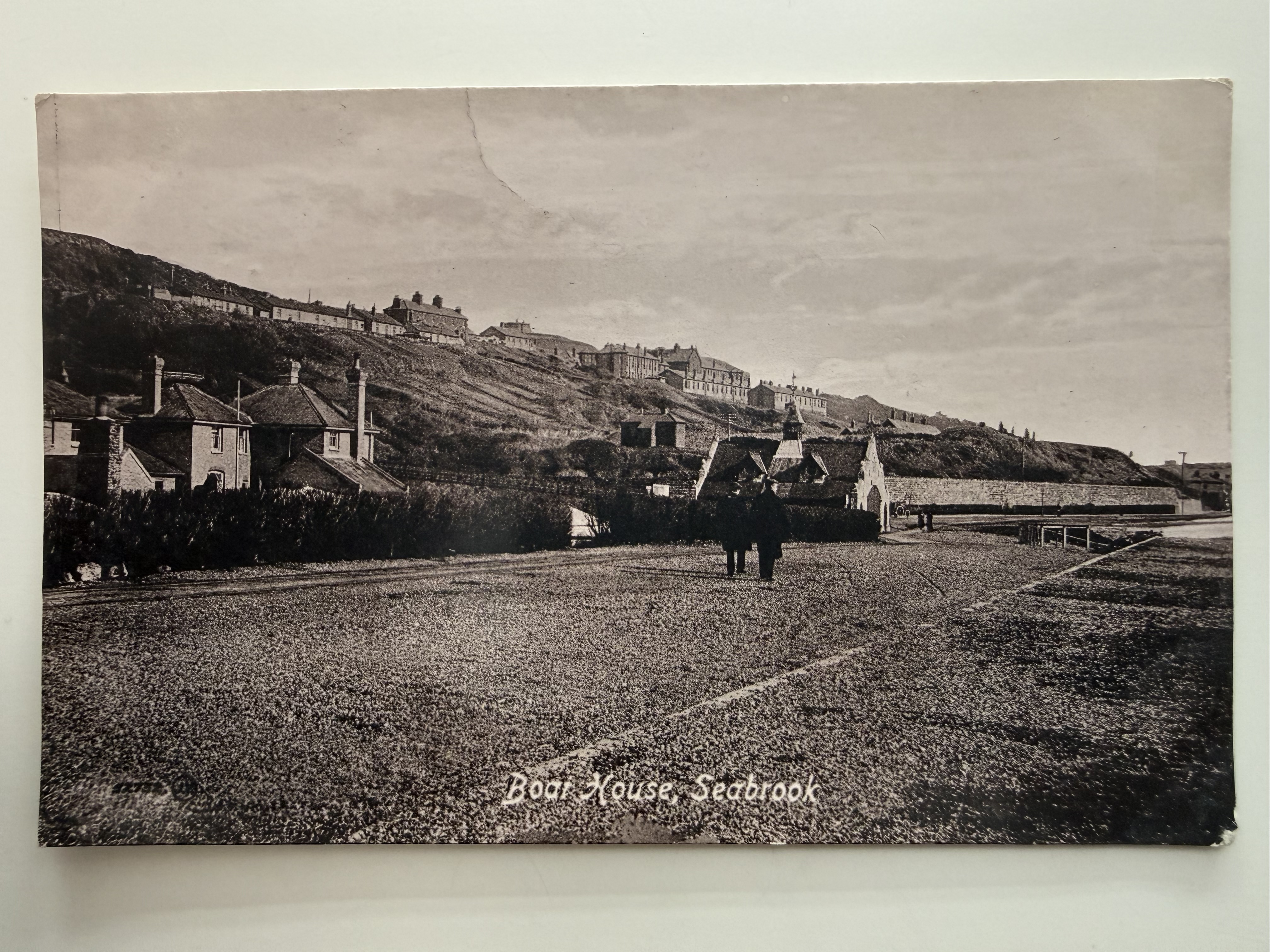
Seabrook Postcard Multi
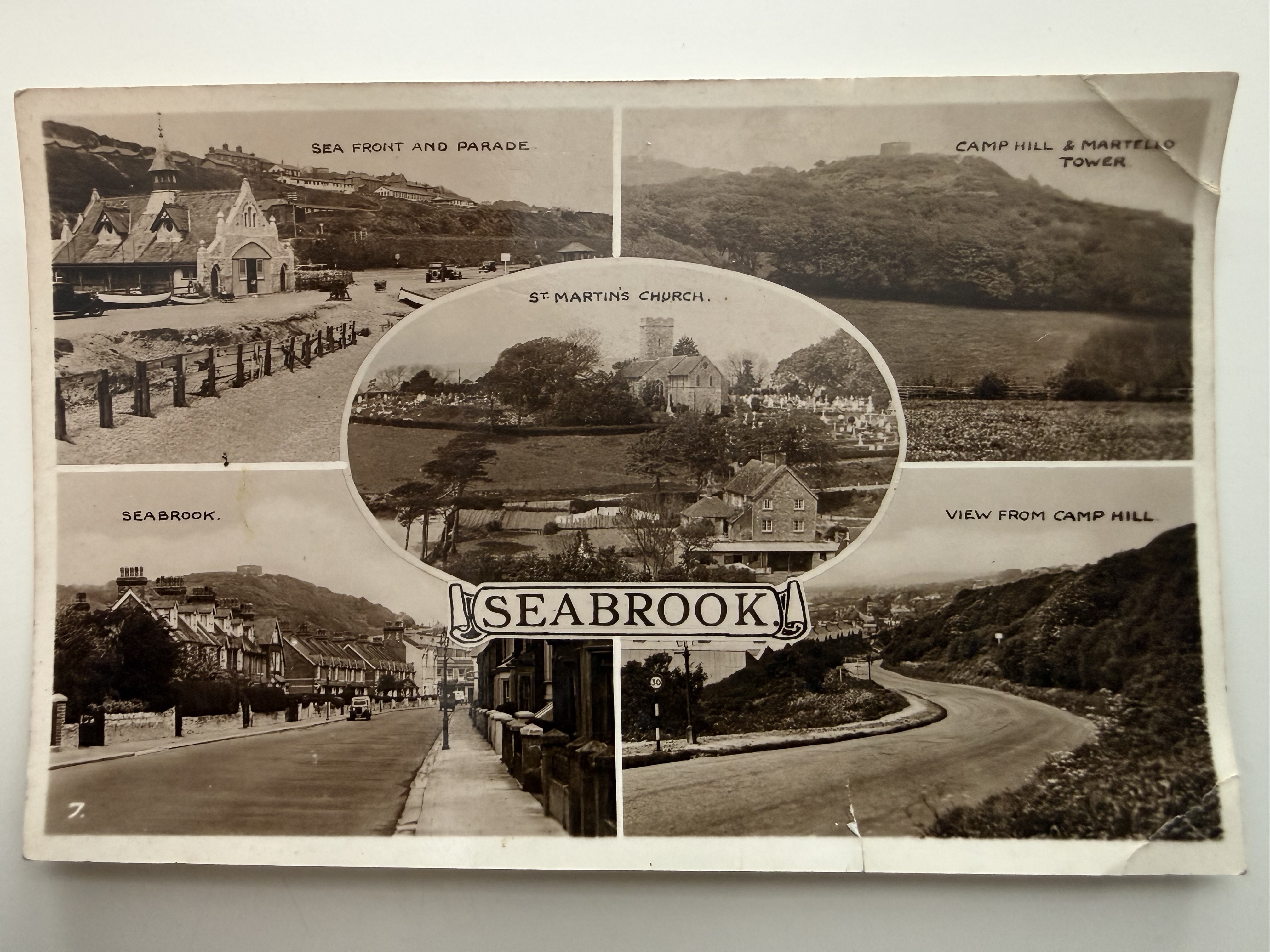
This composite postcard presents a series of views capturing key landmarks and scenes around Seabrook, including the sea front and parade, Camp Hill with its Martello tower, St Martin's Church, and roadside views of the village itself. Together, the images illustrate the character of Seabrook as both a coastal and rural community, with its mix of shoreline, hillside, and residential development. The inclusion of winding roads, open fields, and established buildings reflects a period when the area was evolving into a small seaside destination while still retaining much of its natural landscape and quiet village atmosphere. Held in the on-site archives.
Seabrook from Hospital Hill - Looking West
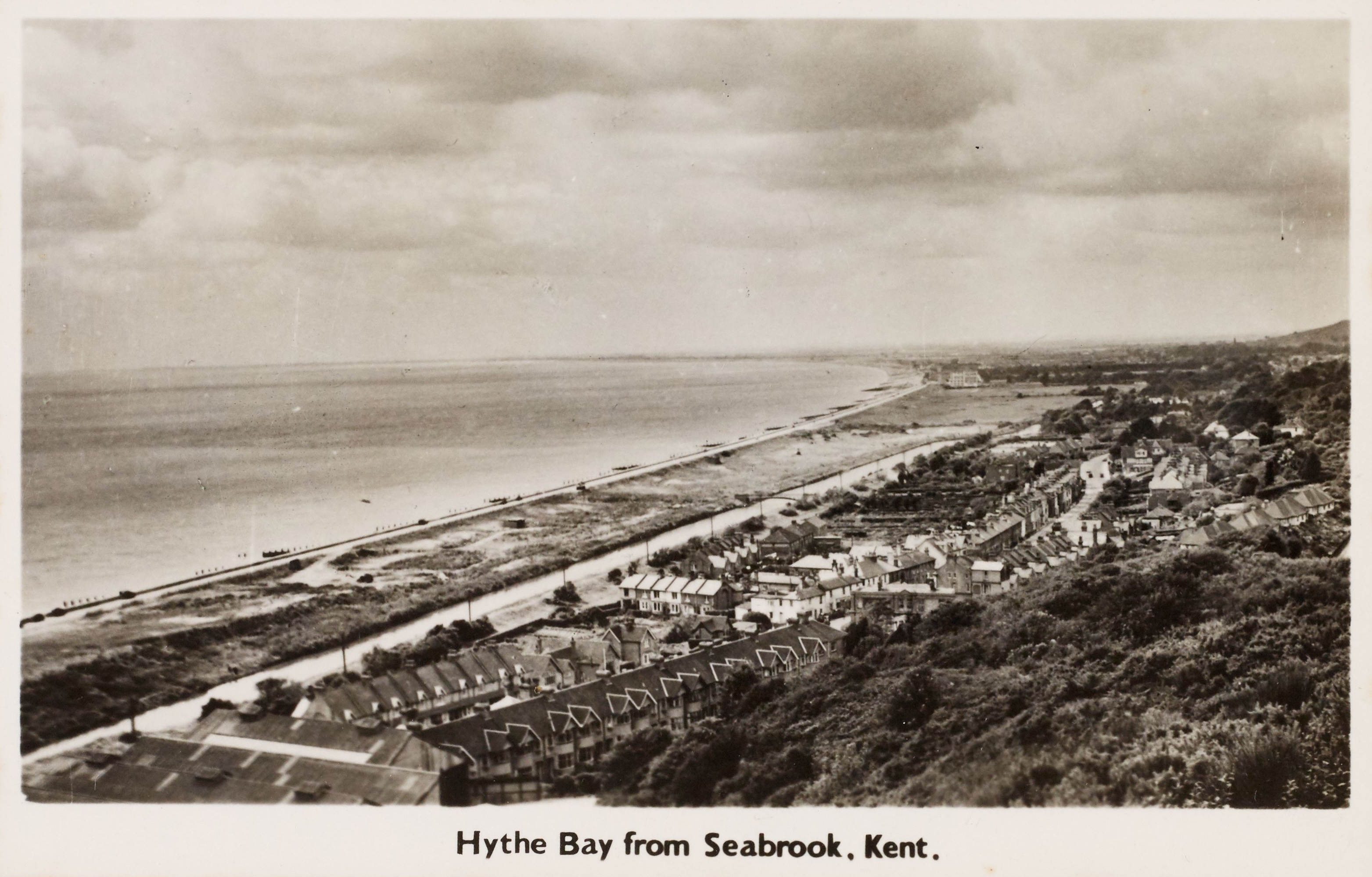
Seabrook from Hospital Hill - Looking West
This wide panoramic view of Seabrook, taken from the rising ground above the village, looks out across the clustered houses, the railway line in the foreground, and the long sweep of coastline beyond. The railway cuts across the scene as a defining feature, linking the settlement to the wider region, while the road winds through the village towards the sea. Rows of modest houses and a few larger buildings line the route, reflecting a growing but still compact community. Beyond, the open shoreline and sea dominate the horizon, emphasising Seabrook's identity as a developing coastal settlement where transport, landscape, and seaside location combined to shape its character.
Seabrook from Cliff Road, looking East
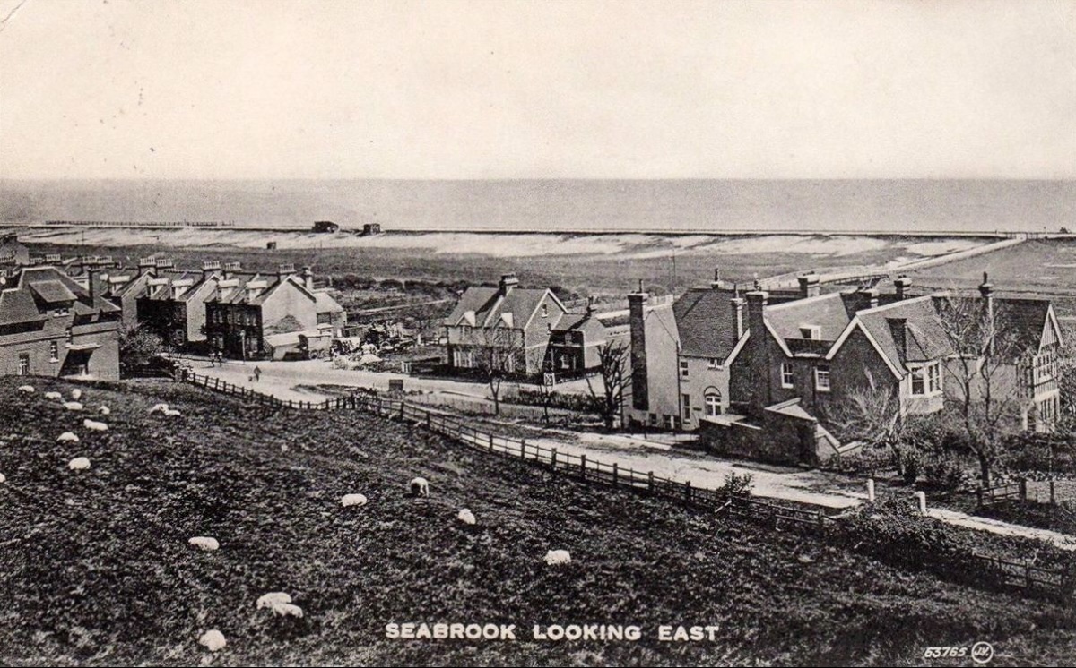
This photograph captures an eastward view across Seabrook, showing a small coastal settlement of houses and guest accommodation clustered along the road with open farmland in the foreground. Sheep graze on the sloping fields, emphasising the rural character of the area at the time, while beyond the buildings the wide expanse of shoreline and sea stretches across the horizon. Prominent among the larger properties is what is believed to be the Sea View Hotel, one of several establishments that catered to visitors drawn to the coast. The image illustrates the transition of Seabrook from an agricultural landscape into a modest seaside destination, with development still relatively sparse and closely tied to the natural surroundings.
Cliff Road, Seabrook, looking North
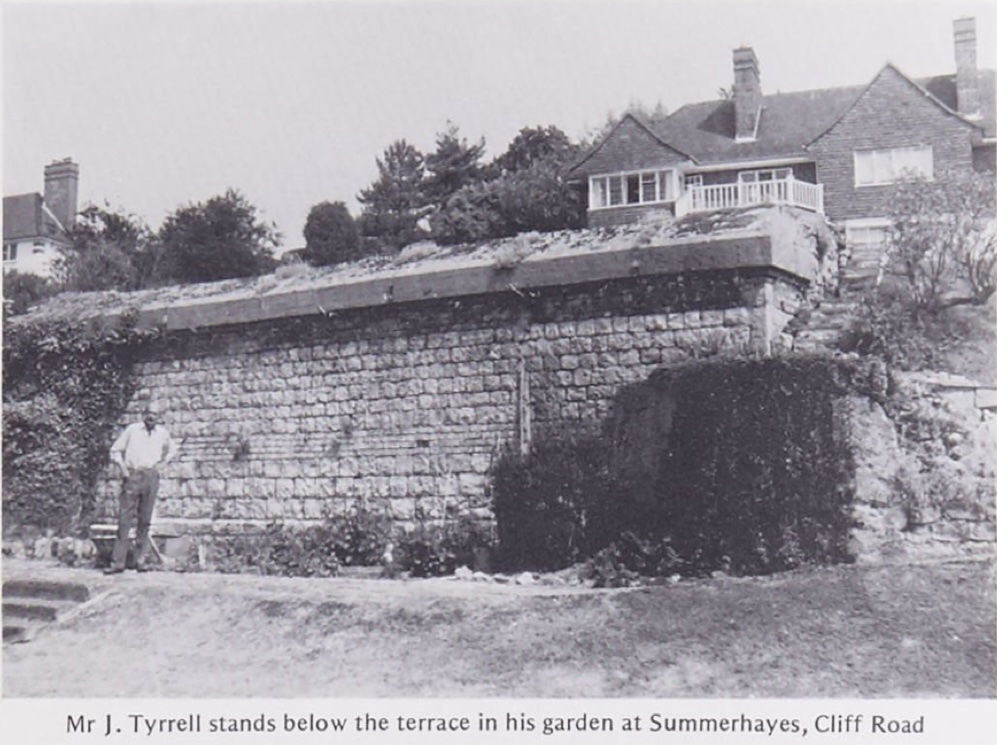
Photograph showing Mr J. Tyrrell standing in his garden below the substantial terrace wall at Summerhayes on Cliff Road, Seabrook. The image highlights the elevated position of the property, with its stone retaining wall supporting the house and garden above, overlooking the lower ground. The substantial construction reflects both the engineering required to stabilise the cliffside plots and the desirable nature of these coastal residences, which offered expansive views across the surrounding landscape and towards the sea.
Sea View Hotel, Seabrook, looking North
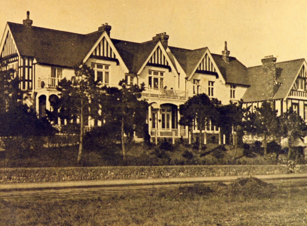
Photograph showing the Sea View Hotel in Seabrook, a large Victorian seaside building characterised by decorative gables, timber detailing, and balconies overlooking the coast. Set within landscaped grounds above the roadway, the hotel formed part of the ambitious Seabrook Estate development, intended to attract visitors seeking a refined seaside resort experience. The image reflects the scale and architectural style of Seabrook's planned expansion during this period, as well as its role as a destination for holidaymakers travelling along the Kent coast. Held in the on-site archives.
260 Seabrook Road, looking east, now Eastcott Terrace, Seabrook
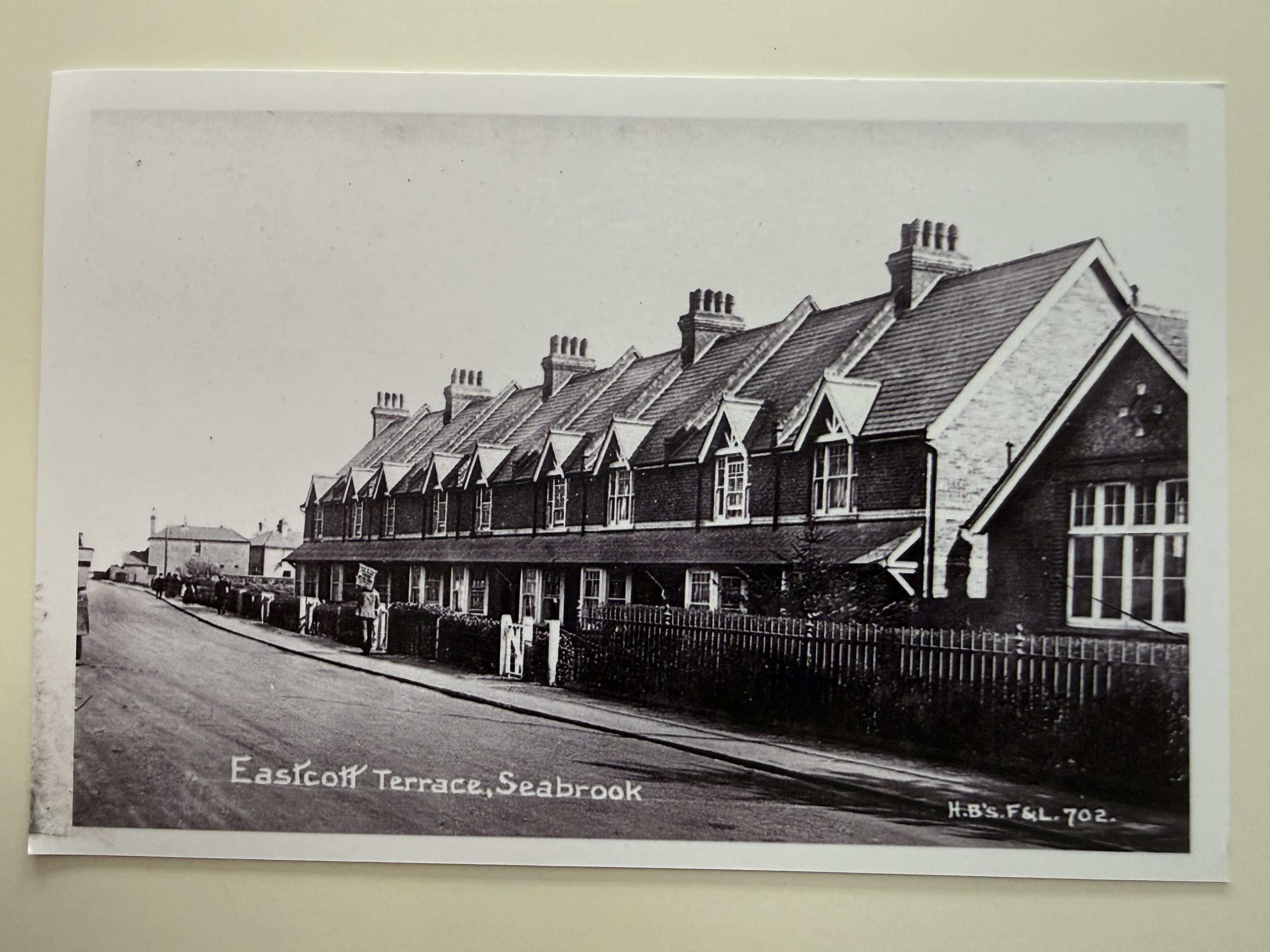
Reproduction photograph showing Eastcott Terrace along Seabrook Road, including part of Seabrook School. Published as H.B. F4L 702, the image captures the character of this residential stretch in its earlier form. Held in the on-site archives.
218 Seabrook Road, looking west
188 Seabrook Road, Looking East
Valentine Series postcard showing Seabrook Road viewed eastwards, opposite what is now 188 Seabrook Road. The image captures a quieter streetscape of terraced housing and everyday life in the village. Held in the on-site archives.
158 Seabrook Road, looking East
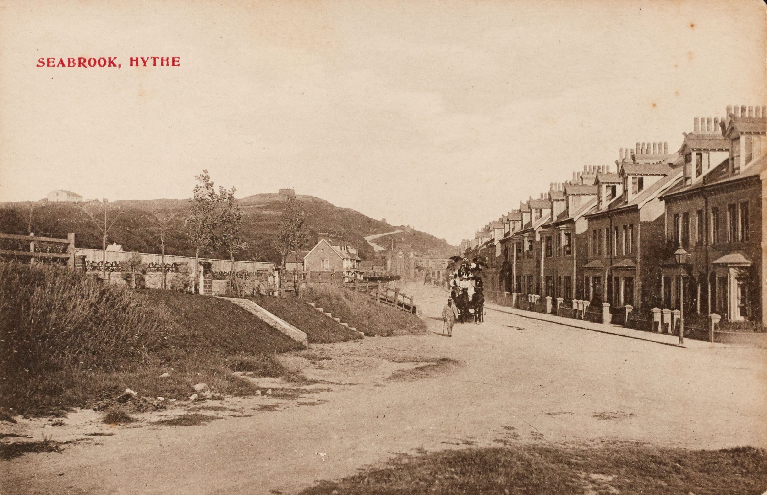
This photograph shows a quiet street scene in Seabrook, Hythe, with a row of neatly built terraced houses lining the right-hand side of the road, their uniform chimneys and façades reflecting the planned development of the area. A horse-drawn carriage travels along the wide, unpaved roadway, accompanied by a few pedestrians, capturing a moment of everyday life in the village before the widespread use of motor vehicles.
155 Seabrook Road, looking West
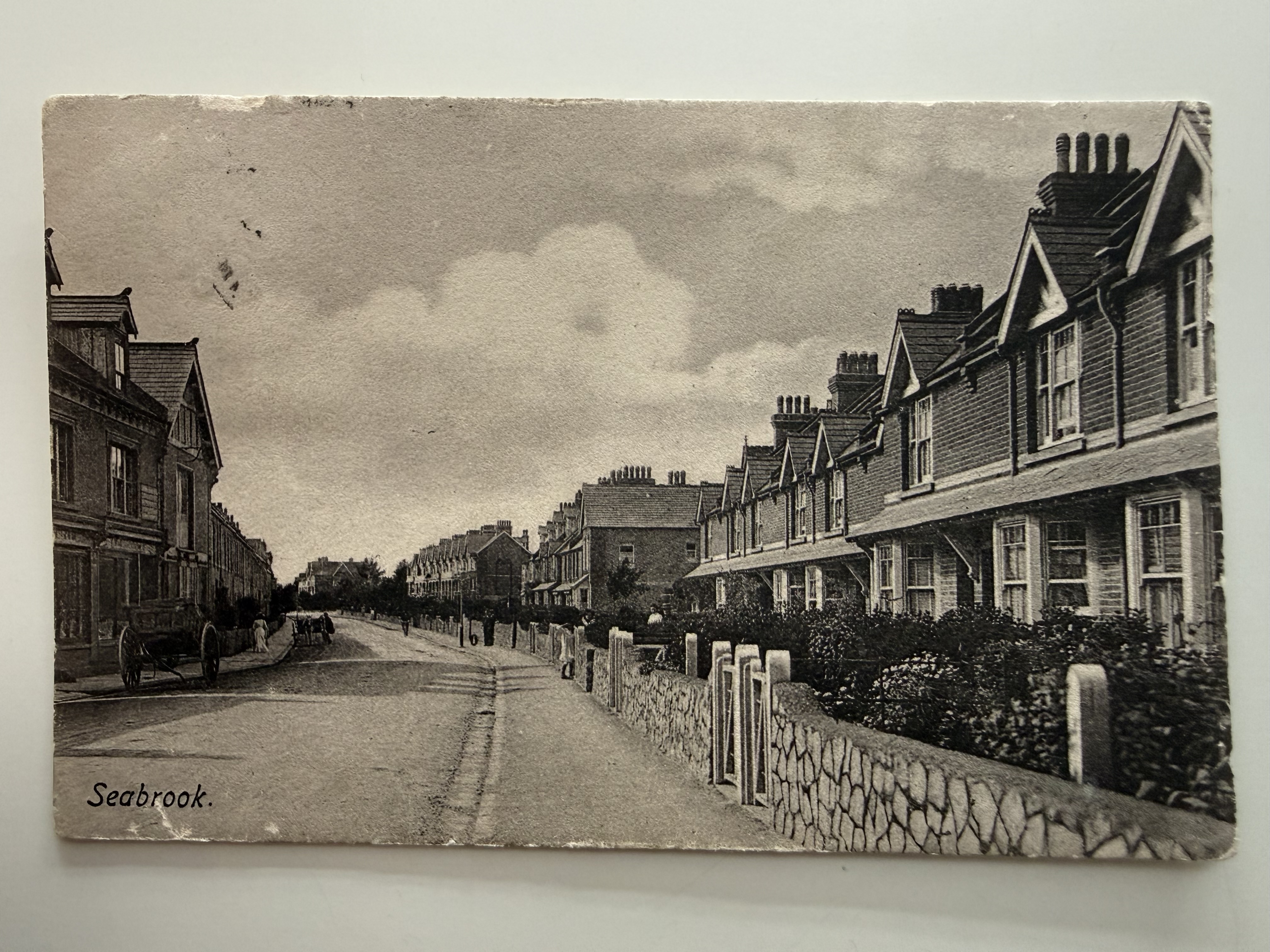
Postcard view of Seabrook Road, opposite what is now 155 Seabrook Road, showing rows of terraced houses and a quiet village streetscape. The image captures everyday life in Seabrook before modern development. Held in the on-site archives.
155 Seabrook Road (1904), looking West
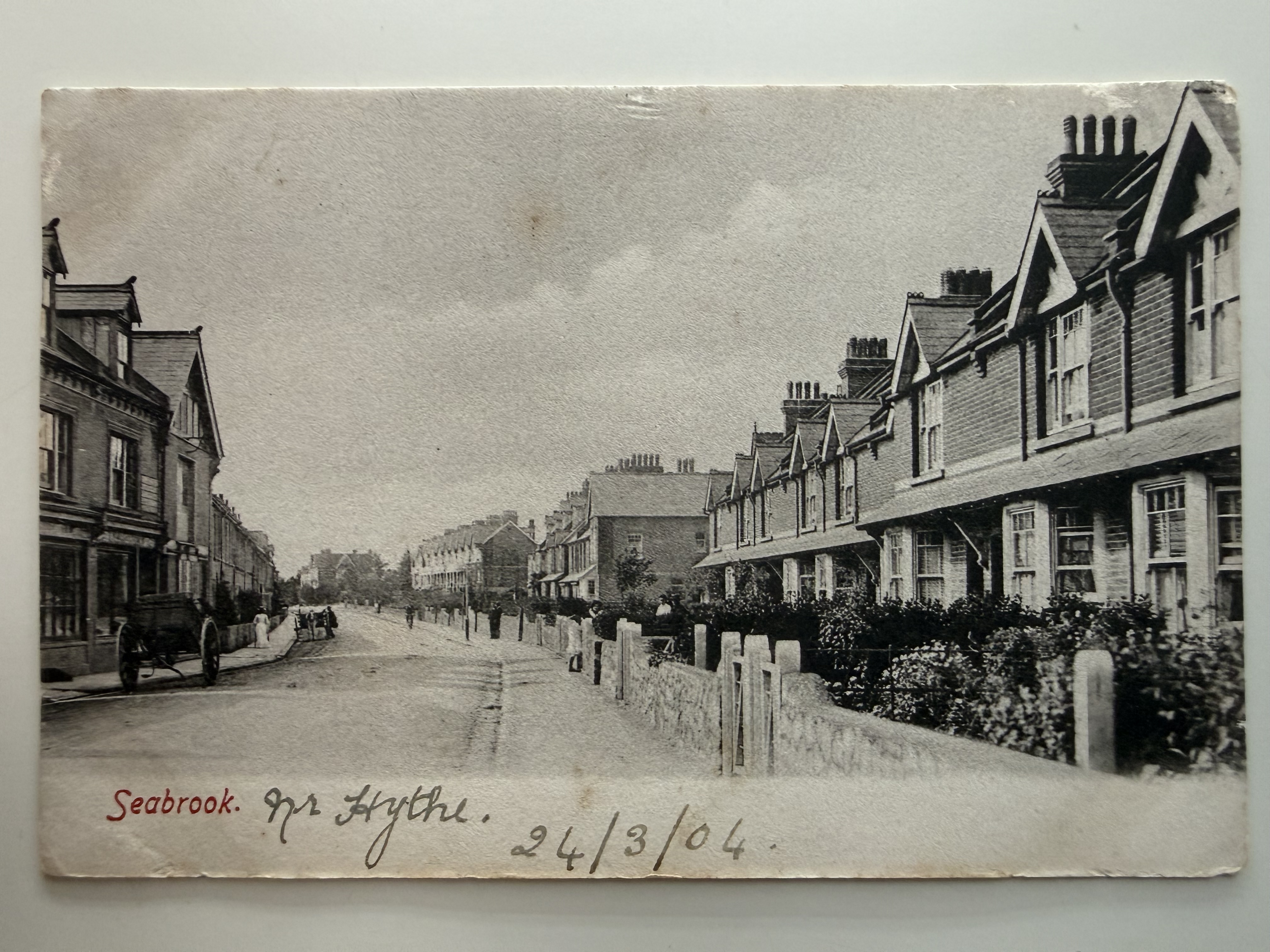
Postcard view of Seabrook Road looking towards Hythe, opposite what is now 155 Seabrook Road. Dated 24 March 1904, the image shows early terraced housing and a quiet village street scene at the turn of the 20th century. Held in the on-site archives.
103 Seabrook Road, looking East
Reproduction photograph showing Seabrook Road around what is now 103 Seabrook Road, with a row of large houses and Martello Tower visible in the background. The image captures a more developed residential character along this stretch of the village. Held in the on-site archives.
81 Seabrook Road, looking east, Seabrook House Bed and Breakfast formerly Main Road
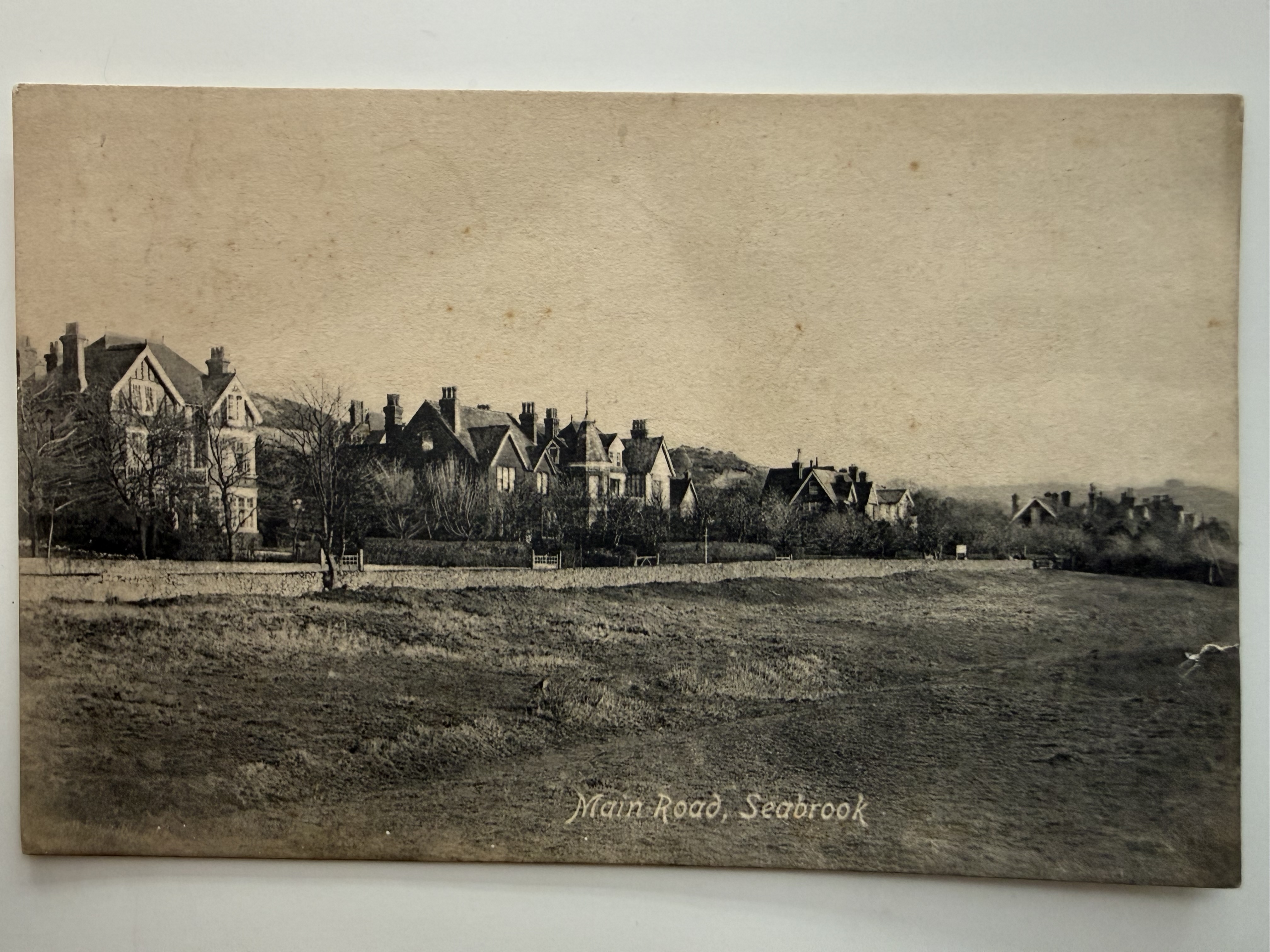
Postcard view of Main Road (now Seabrook Road), looking east from around what is now 81 Seabrook Road, the site of Seabrook House. The image shows large detached houses set back from the road, reflecting the area's early residential development. Held in the on-site archives.
71 Seabrook Road, The Sanctuary, looking north
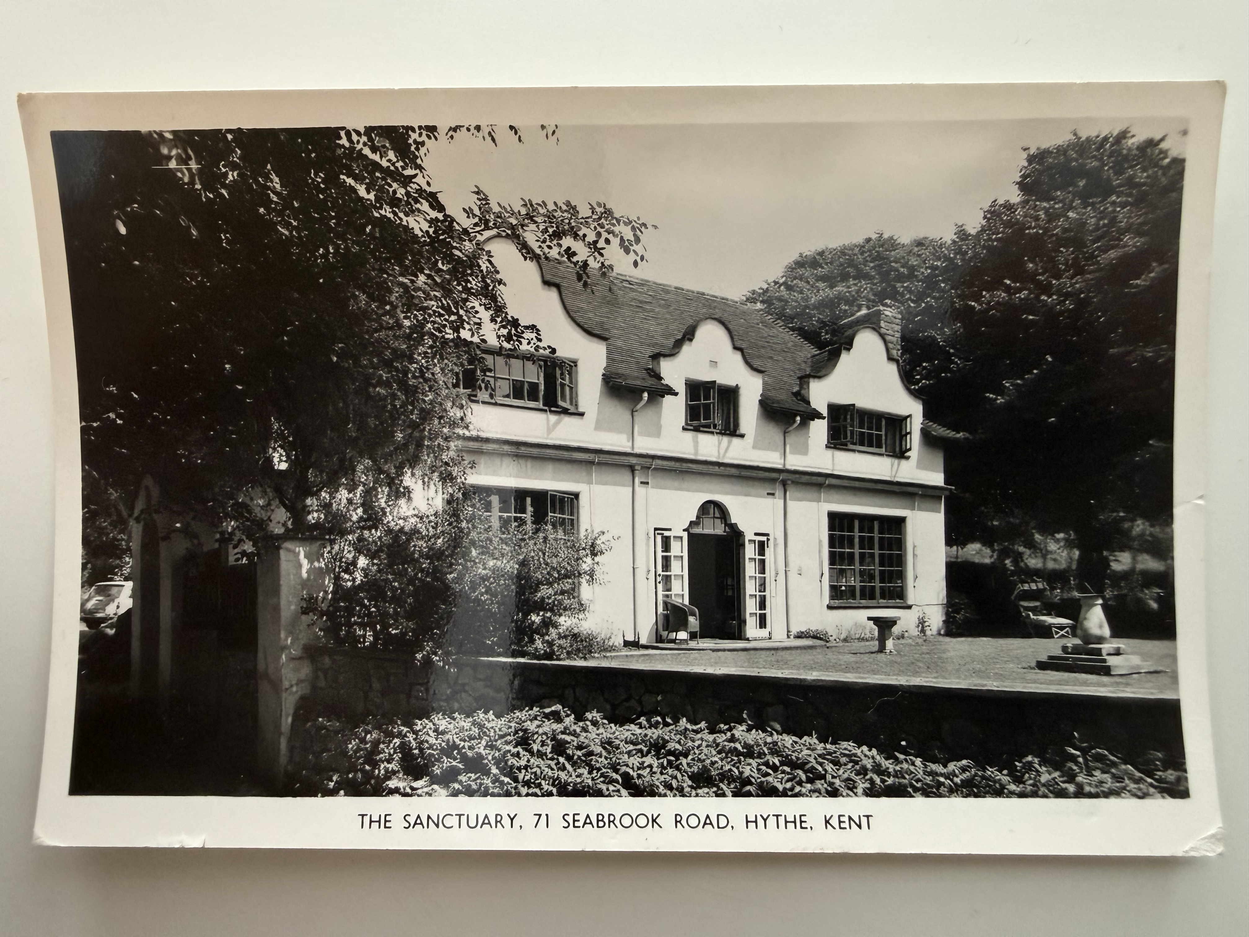
Photograph of "The Sanctuary," at what is now 71 Seabrook Road, Hythe. The image shows the distinctive house set within its garden, reflecting the character of Seabrook's larger residential properties. Held in the on-site archives.
The Britannia, Horn Street, 1890
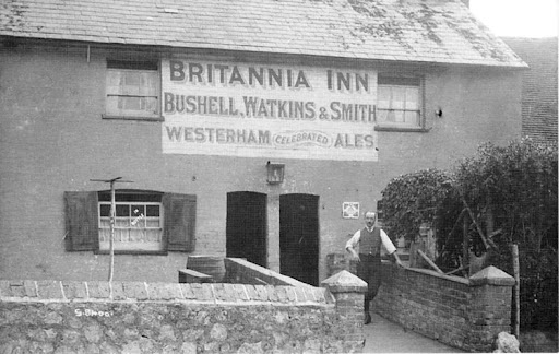
The Britannia Inn, This photograph shows the Britannia Inn on Horn Street, a modest but characterful public house with a large painted advertisement across its upper wall reading "BRITANNIA INN – Bushell, Watkins & Smith – Westerham Celebrated Ales." The building appears to be of simple construction with shuttered windows and a tiled roof, set behind a low stone wall and accessed by a small gateway and path. A man, likely the landlord or a member of staff, stands casually in the entrance, adding a human presence to the scene. The image reflects the typical appearance of a local village pub in the late 19th or early 20th century, where brewery signage was prominently displayed and the inn served as a focal point for the surrounding community.
The Fountain, 1906
The Fountain in 1900
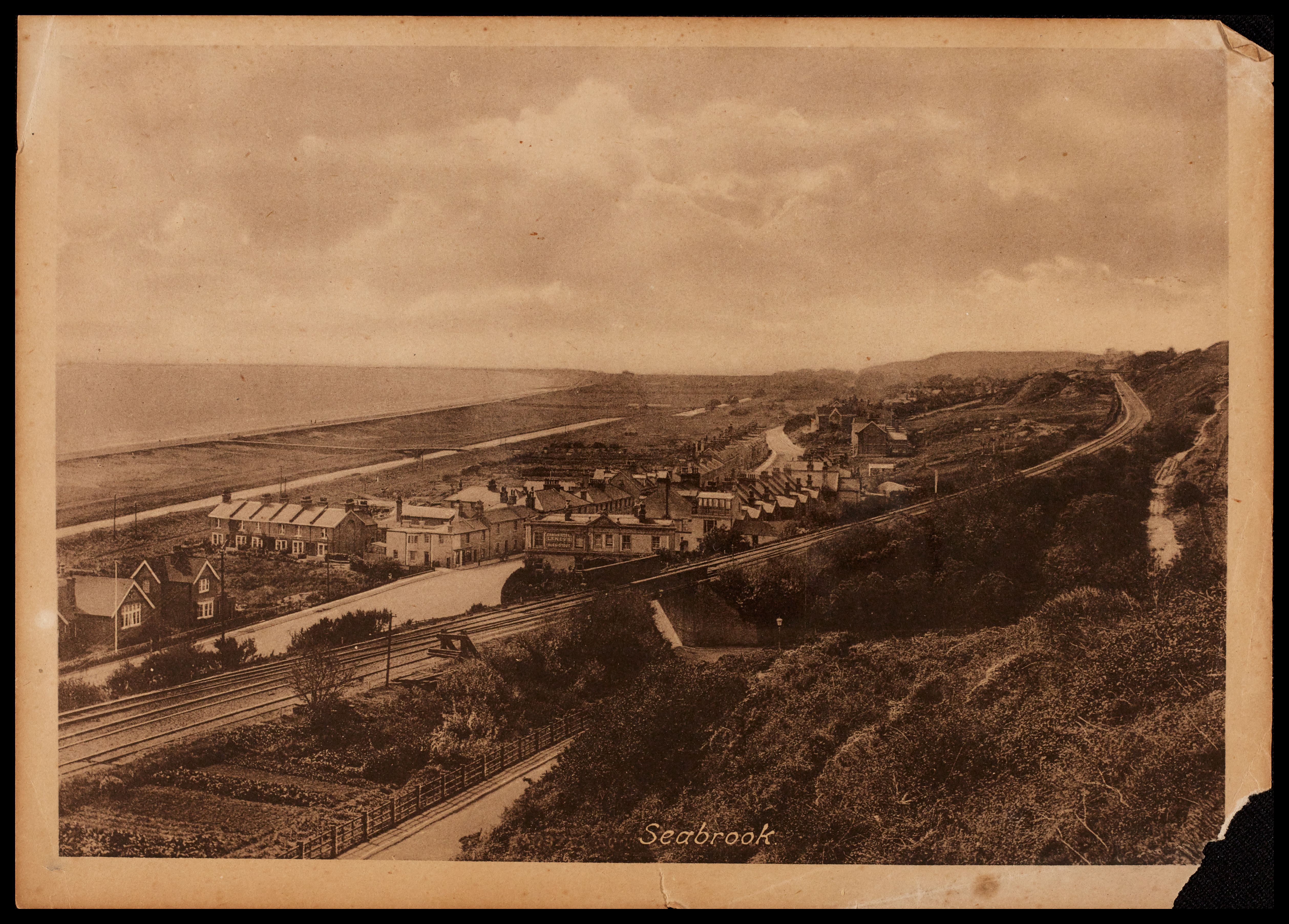
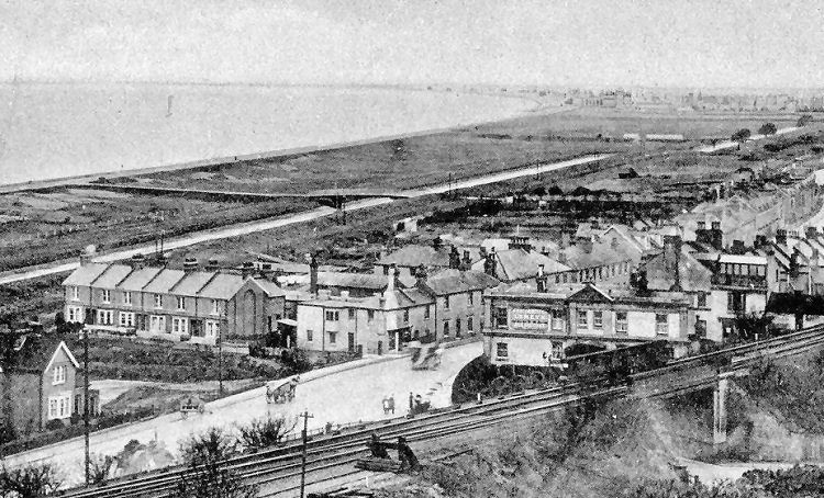
This elevated view looks across Seabrook towards the coastline, showing a cluster of houses and local buildings gathered along the road, with the sea and shoreline stretching out behind. In the foreground, the railway line runs prominently across the scene, carried over the landscape by an embankment and bridge, highlighting the importance of rail connections to the area's development. Nearby, larger structures—possibly workshops or industrial buildings—stand alongside residential properties, illustrating the mix of industry and village life. The open coastal strip beyond remains largely undeveloped, emphasising the contrast between the growing settlement and the expansive shoreline that drew visitors to this part of the Kent coast.
The Fountain matchbox label
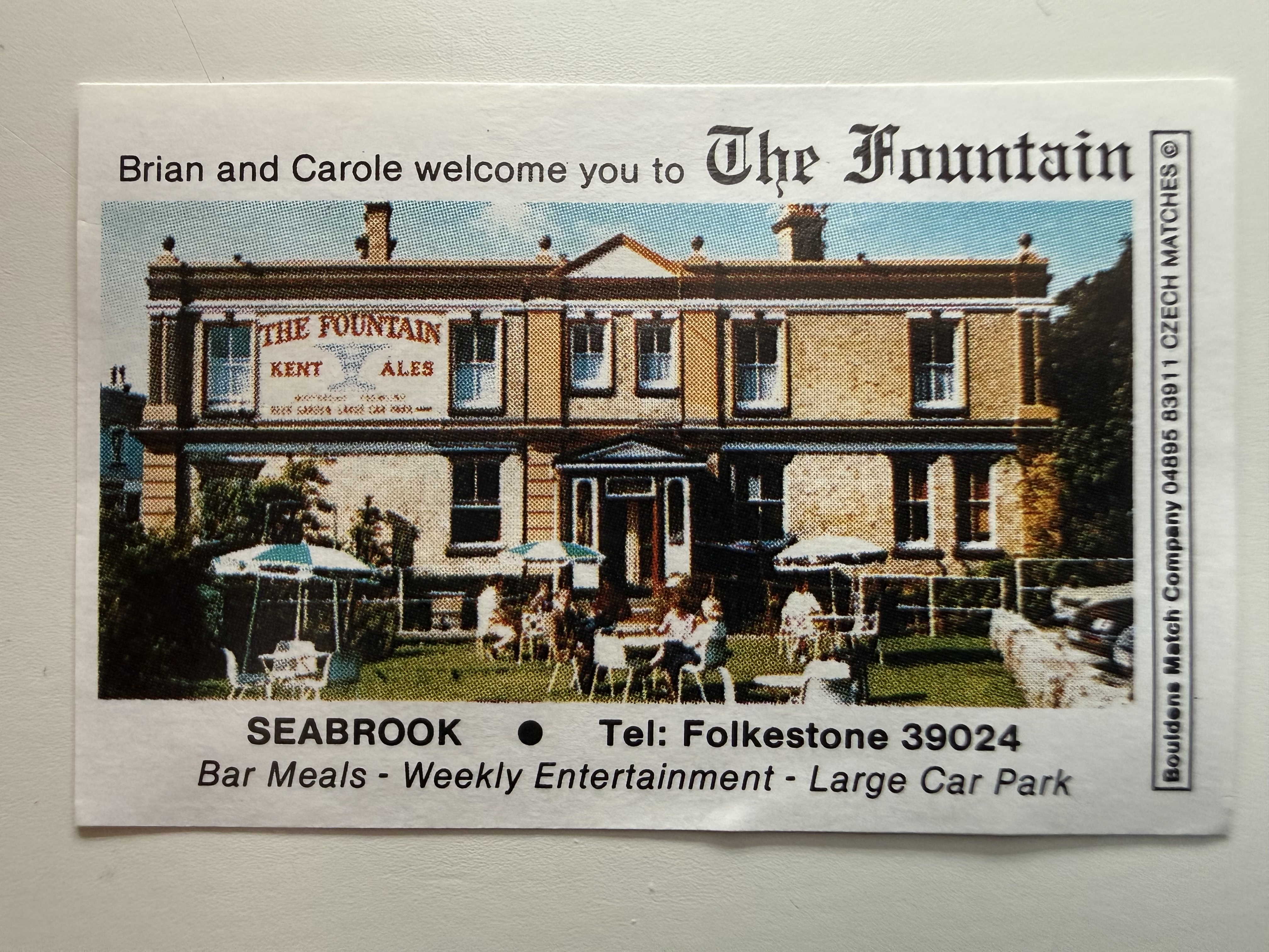
Small promotional matchbox label advertising The Fountain public house in Seabrook, featuring the building and details of bar meals and entertainment. The item reflects local business advertising from the period. Held in the on-site archives.
Horn Street, The Millhouse 1912
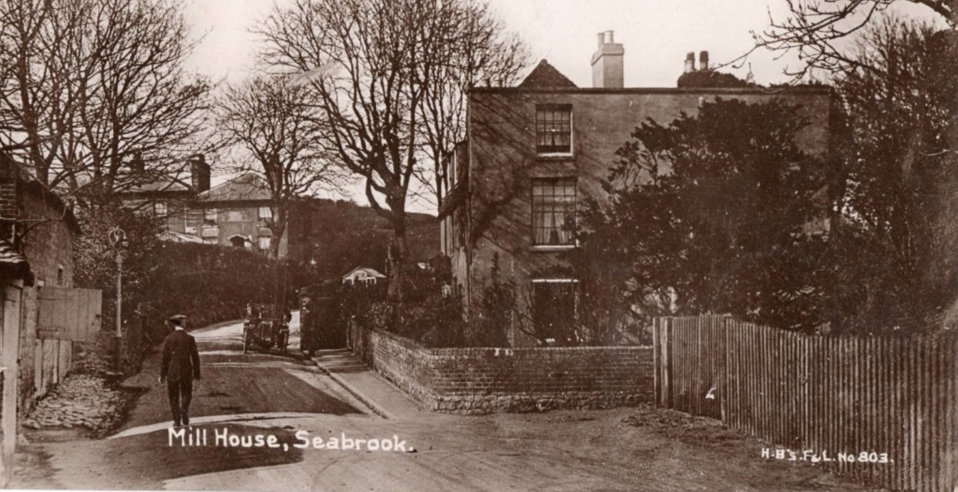
Photograph showing the Millhouse, a prominent building in Seabrook, as it appeared in 1912. The image captures the structure's distinctive architectural features and its setting within the village, reflecting the character of Seabrook during the early twentieth century.
St Martin's Plain, Shorncliffe Camp
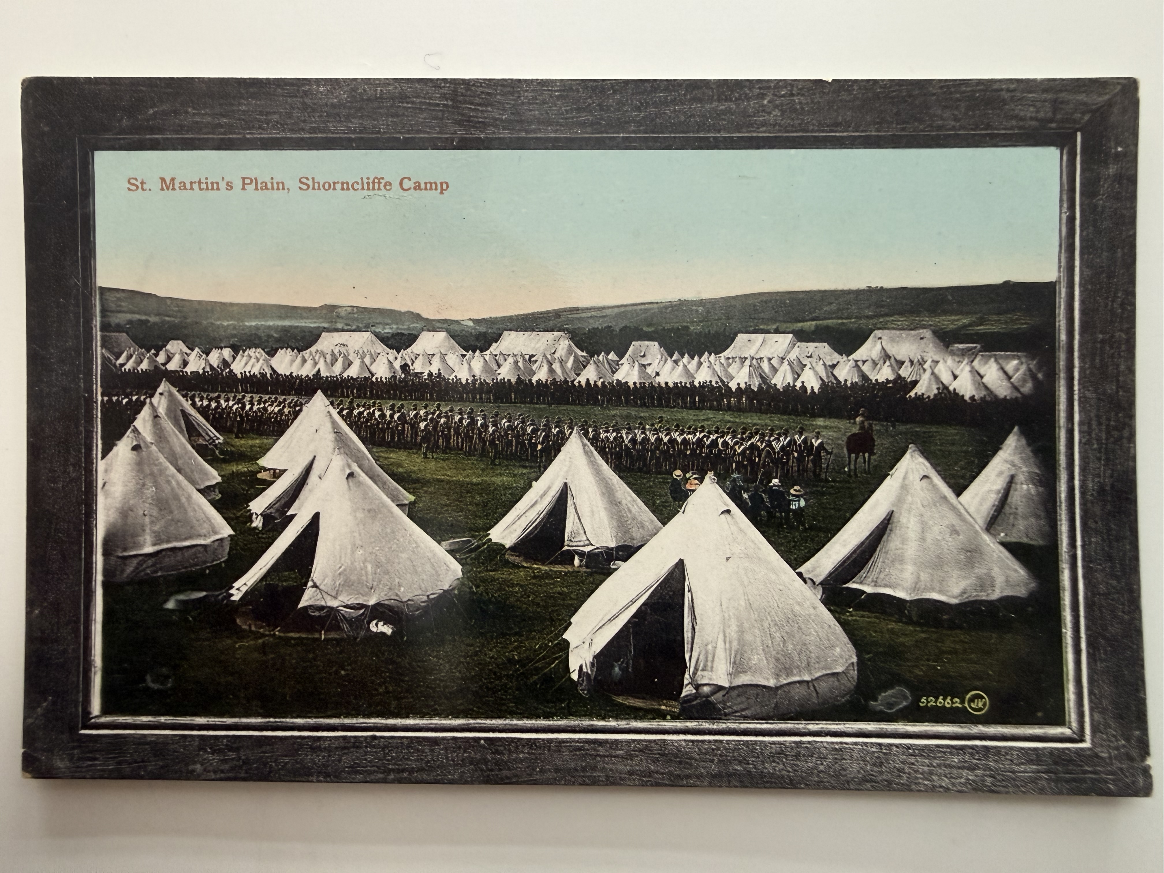
Hand-coloured postcard showing rows of military tents and soldiers assembled on St Martin's Plain at Shorncliffe Camp. The scene reflects the area's long-standing military presence overlooking Seabrook and the surrounding coastline. Held in the on-site archives.
Royal Military Canal
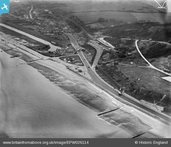
Royal Military Canal
Behind 180 Seabrook Road, Sea View Bridge and Royal Military Canal, looking West
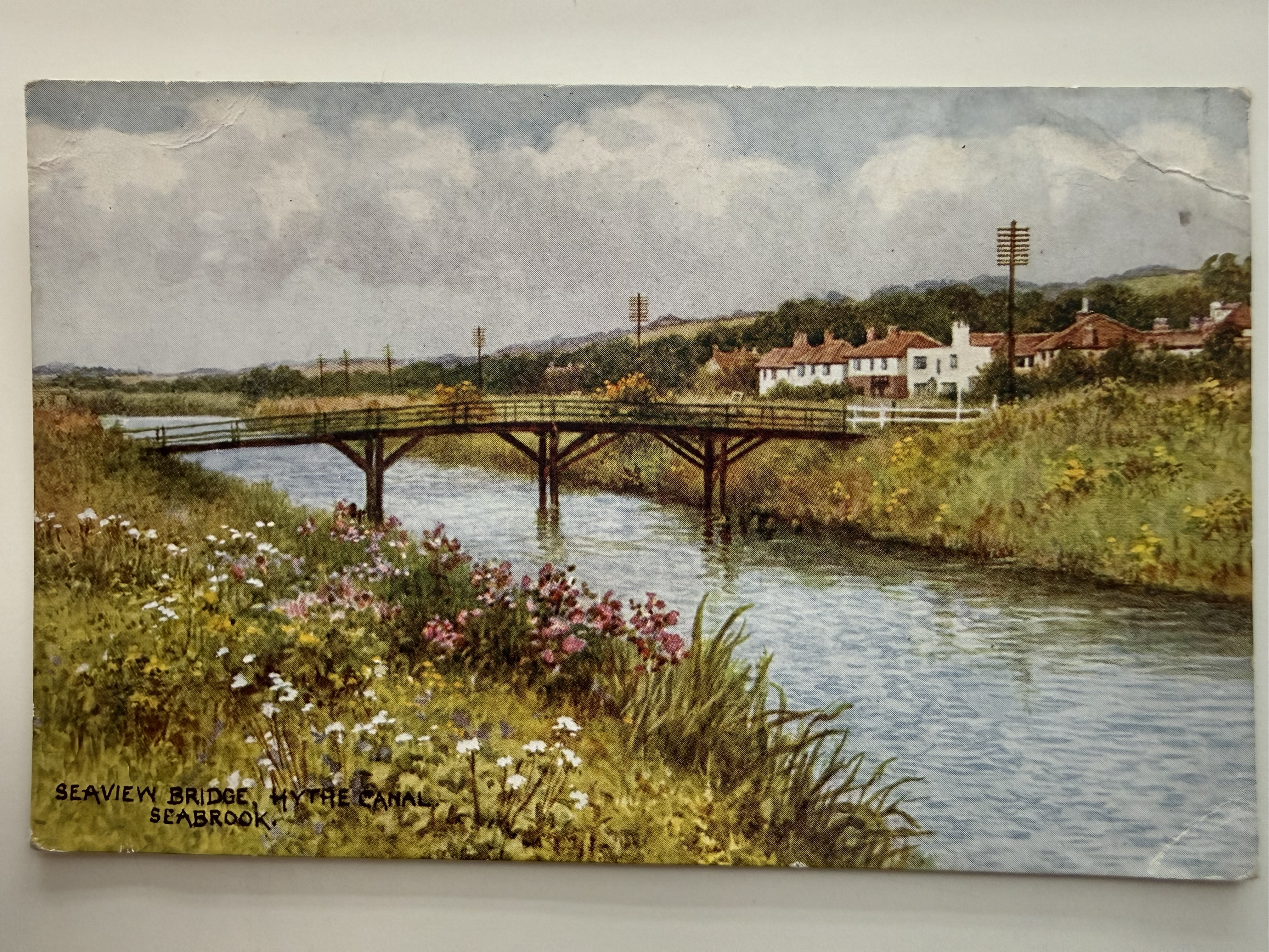
Viewed from behind 180 Seabrook Road this postcard is a hand-coloured postcard showing Sea View Bridge crossing the Royal Military Canal, with Seabrook and the hillside beyond. The scene highlights the rural character of the area before later development. Held in the on-site archives.
Behind 150 Seabrook Road, Sea View Bridge, looking East
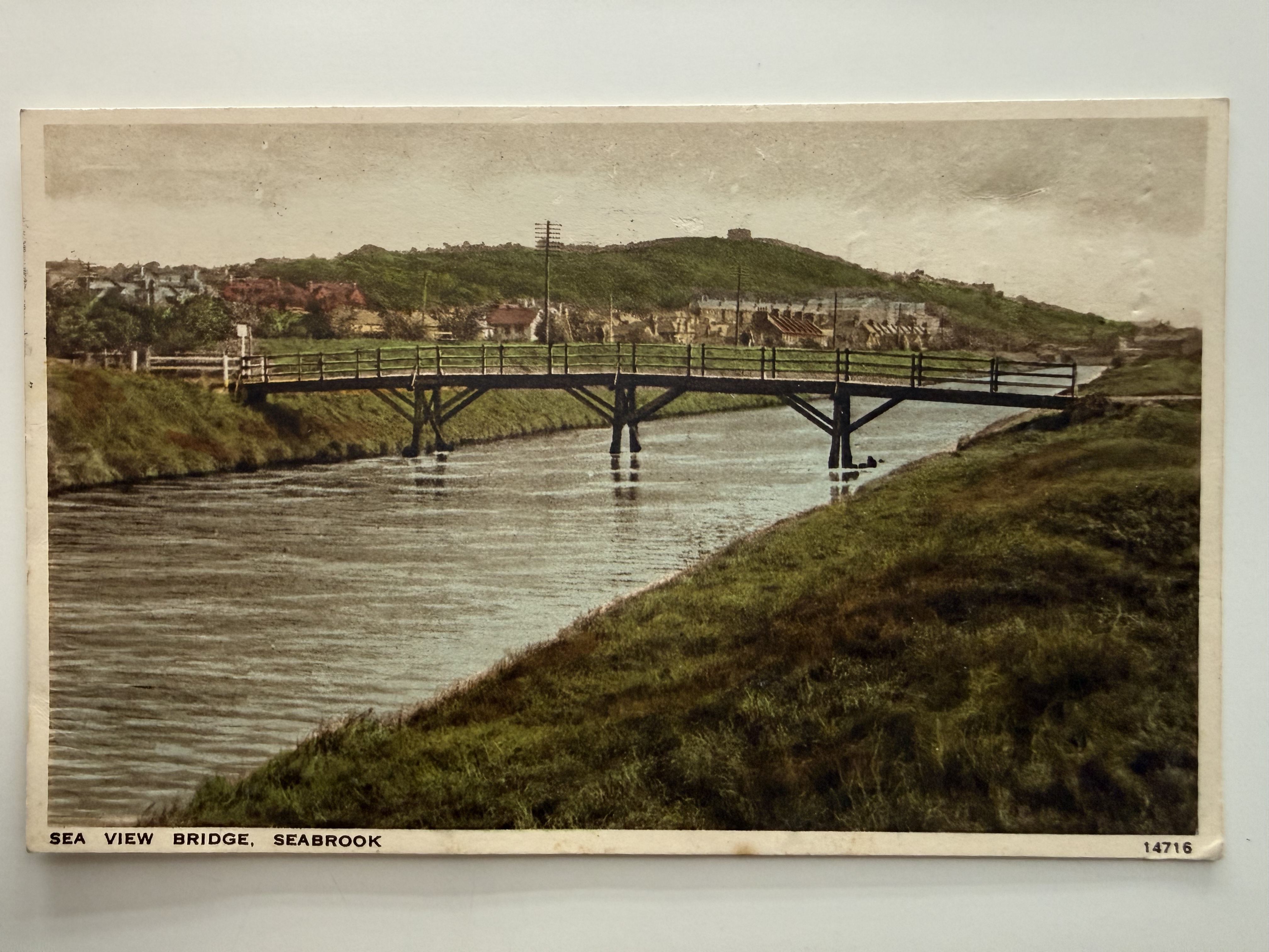
Hand-coloured postcard showing Sea View Bridge over the Royal Military Canal, viewed eastwards from behind what is now 150 Seabrook Road. Seabrook and the hillside beyond form the backdrop to this rural coastal scene. Held in the on-site archives.
106 Seabrook Road, The Canal, looking East
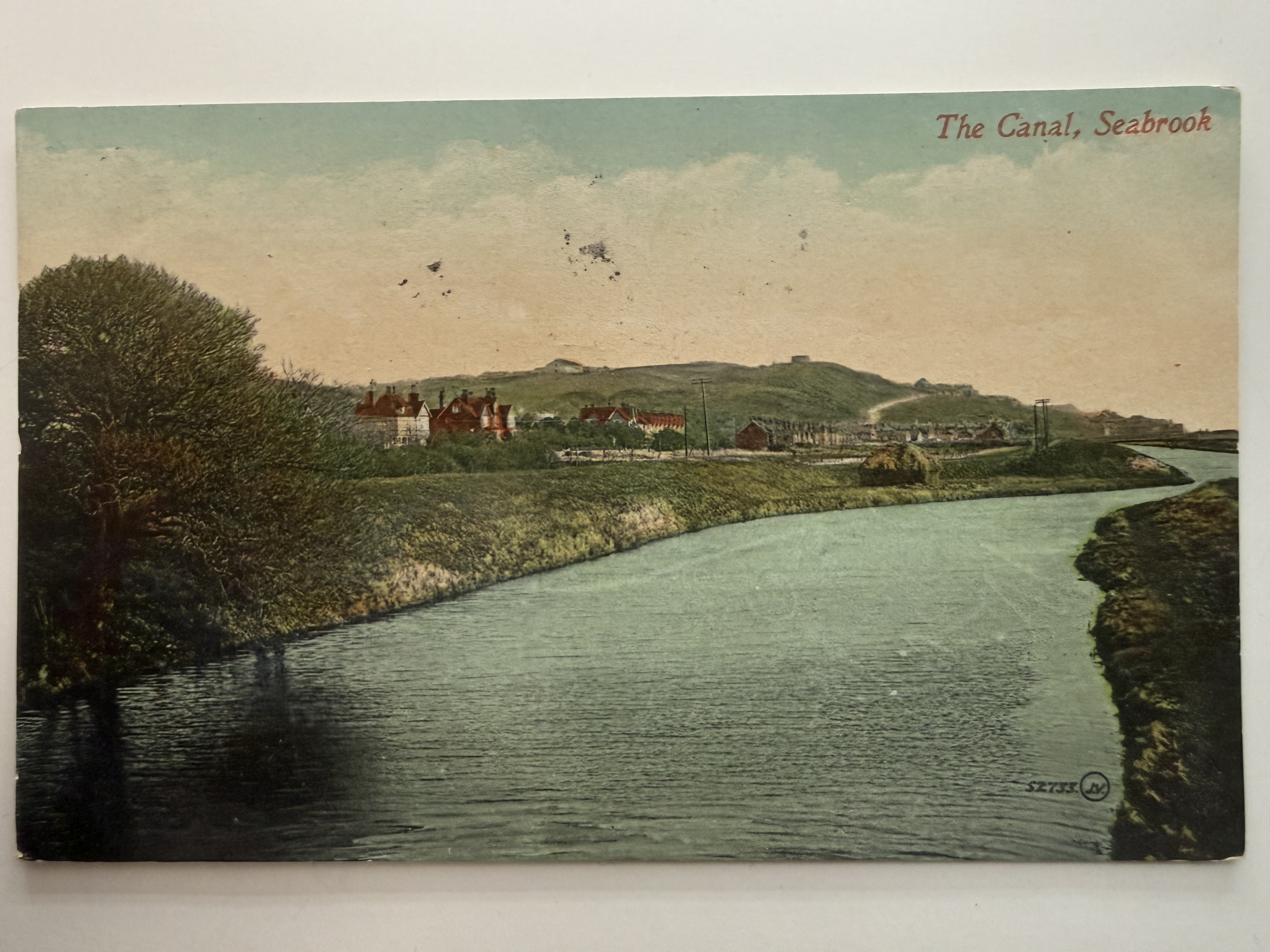
Hand-coloured postcard showing the Royal Military Canal from a bridge behind what is now 106 Seabrook Road, looking along the water towards Seabrook and the hillside beyond. The scene reflects the area's quieter, rural character in the early 1900s. Held in the on-site archives.
Prince's Parade, Looking West
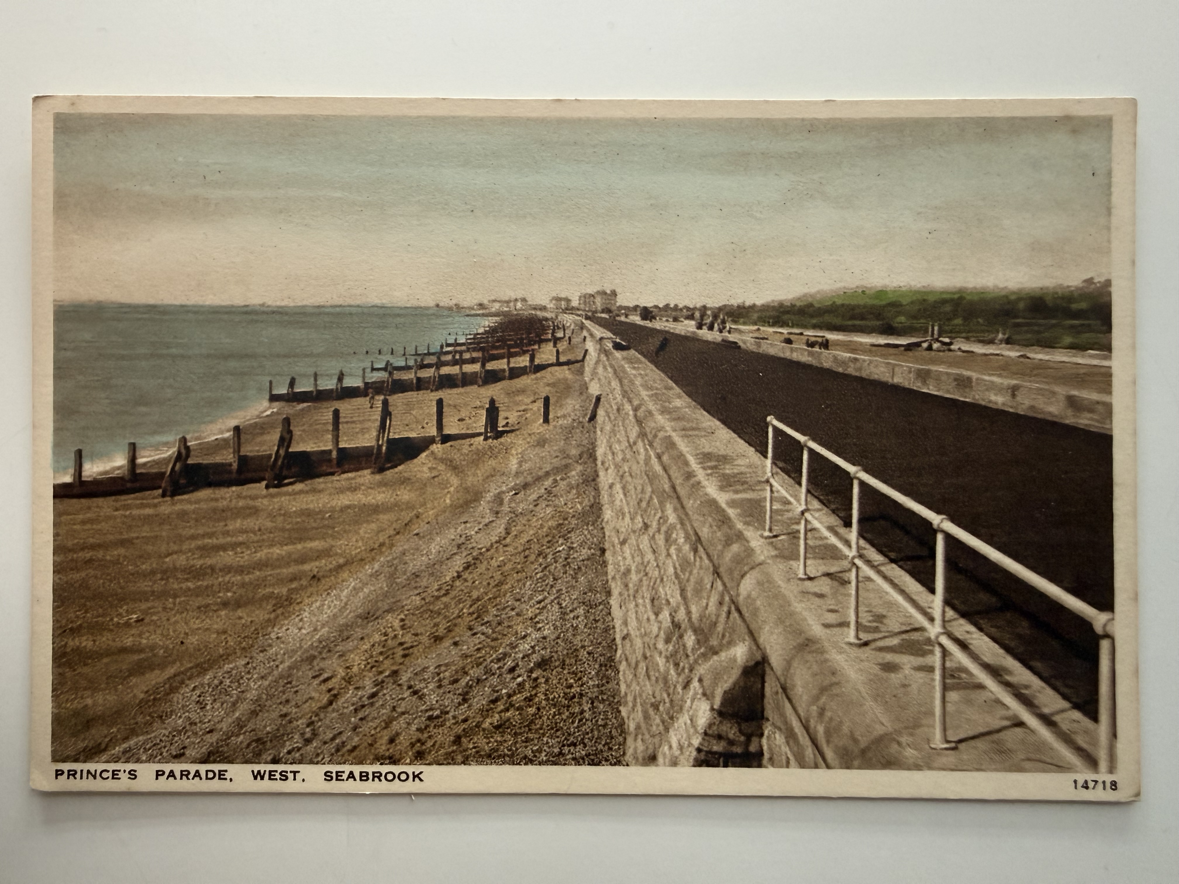
Hand-coloured postcard showing Prince's Parade looking west, viewed from behind what is now 106 Seabrook Road. The sea defences, groynes, and long coastal stretch towards Hythe capture Seabrook's shoreline in an earlier period. Held in the on-site archives.
Prince's Parade, Looking East, Seabrook Beach, the Battery Wall and The Kiosk
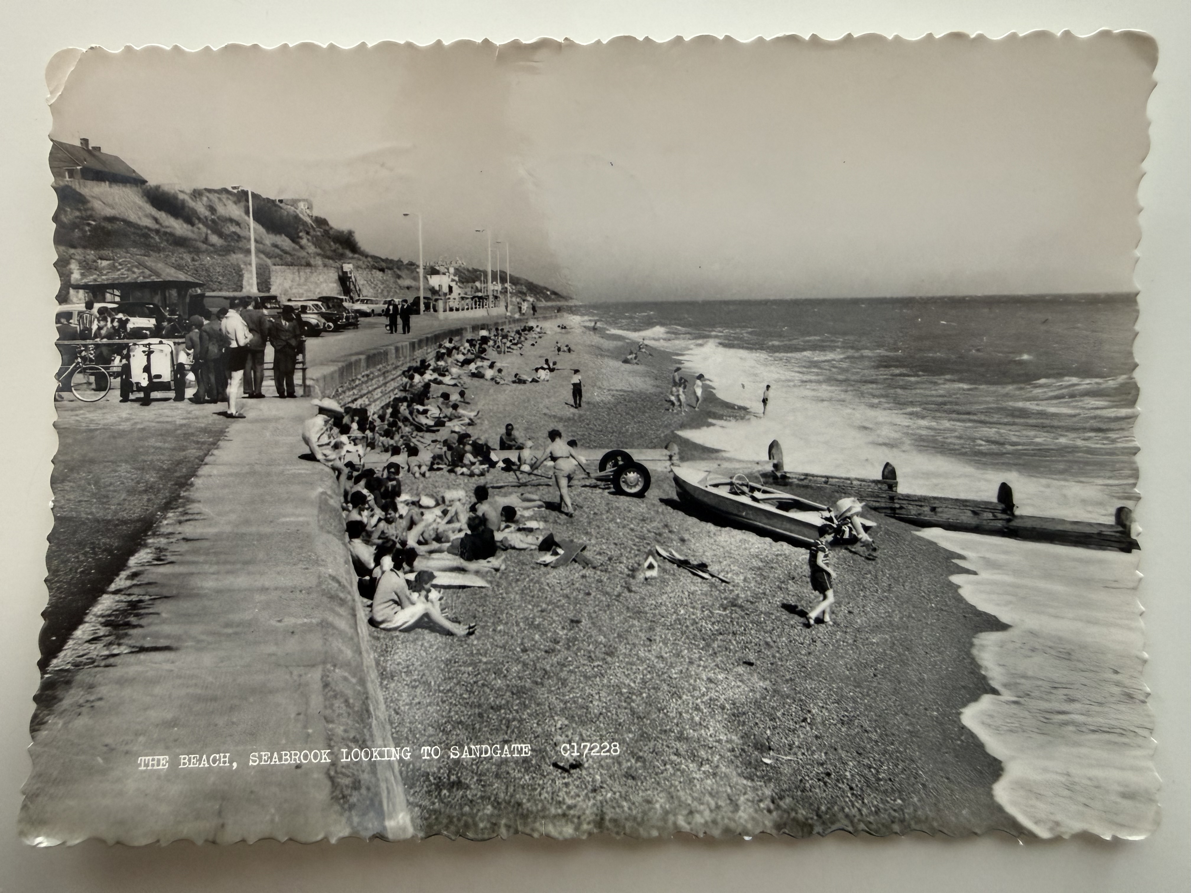
Real photographic postcard by Firth, showing a busy seaside scene along the promenade with beachgoers, fishing boats, and the coastline stretching towards Sandgate. Captures the mid-20th century character of Seabrook as a popular coastal destination. Held in the on-site archives.
Old Lifeboat House, Seabrook
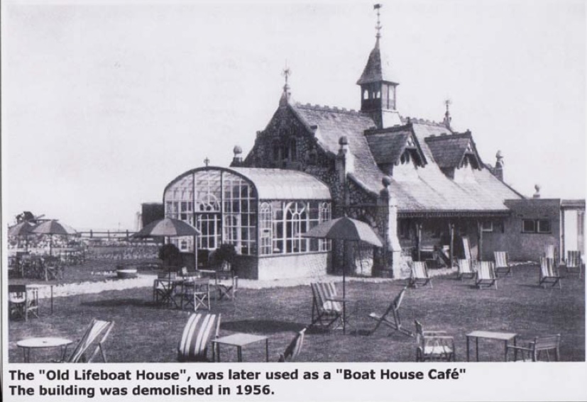
Photograph showing the former lifeboat house on the seafront, later used as the Boat House Café, with its distinctive pitched roofs and glass-fronted extension. Deckchairs and tables in the foreground reflect its use as a seaside leisure spot. The building was demolished in 1956.
Old Lifeboat House, Seabrook, looking East
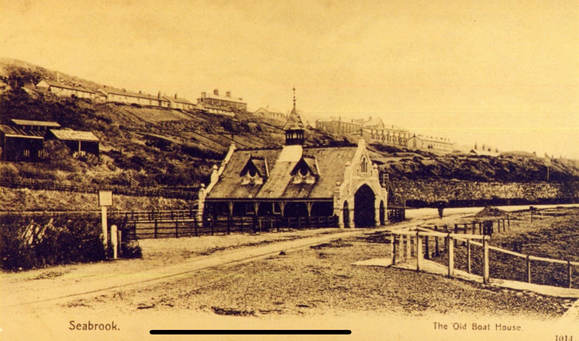
Postcard view of the Old Boat House on the seafront, showing the distinctive building with its central tower and decorative entrance, set below the hillside with terraced houses above. The surrounding paths and fencing reflect the undeveloped coastal landscape of the period.
Old Lifeboat House, Seabrook, looking East from Beach
Real photographic postcard showing the old boathouse viewed from the beach along Princes Parade. The Battery Wall and Hospital Hill rise in the background, capturing Seabrook's early coastal landscape. Held in the on-site archives.
Sandgate Station Staff
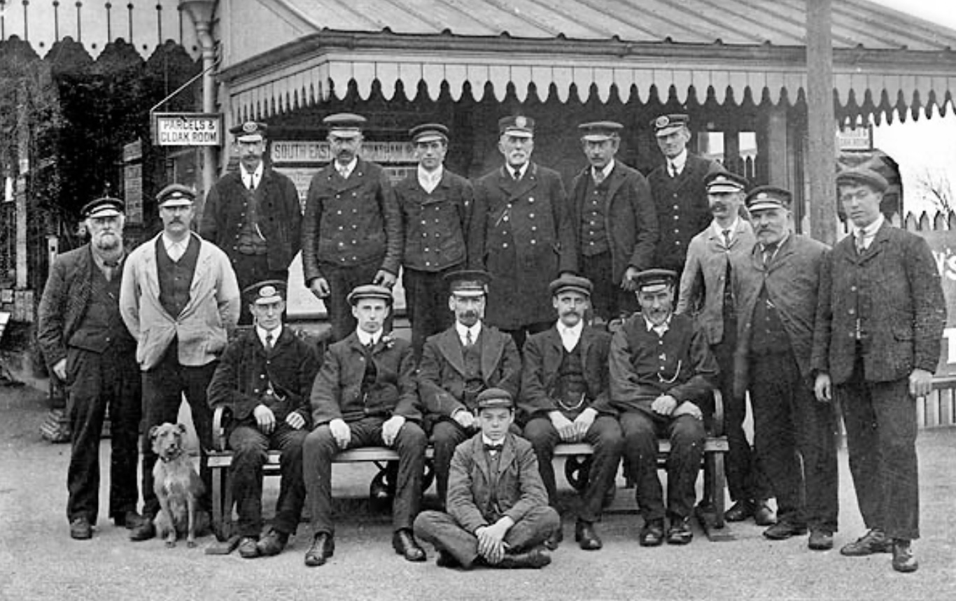
Group photograph of railway staff at Sandgate Station, which was located in Seabrook. The image shows station workers posed in front of the platform buildings, offering a glimpse into the people who operated the local railway. Held in the on-site archives.
Sandgate Station, Seabrook
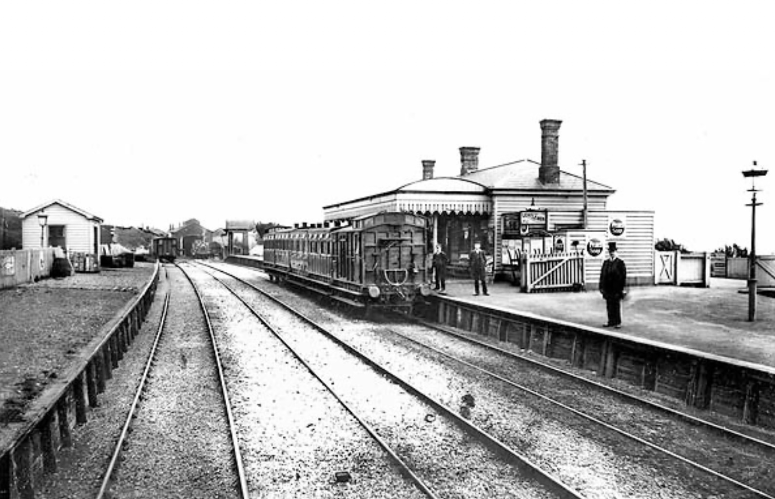
Showing Sandgate railway station, which was located in Seabrook, with a train standing at the platform and staff visible beside the station buildings. The image captures the importance of the railway to the area's development and its connection to the South Eastern Railway network.
Walking Wounded, April 1900
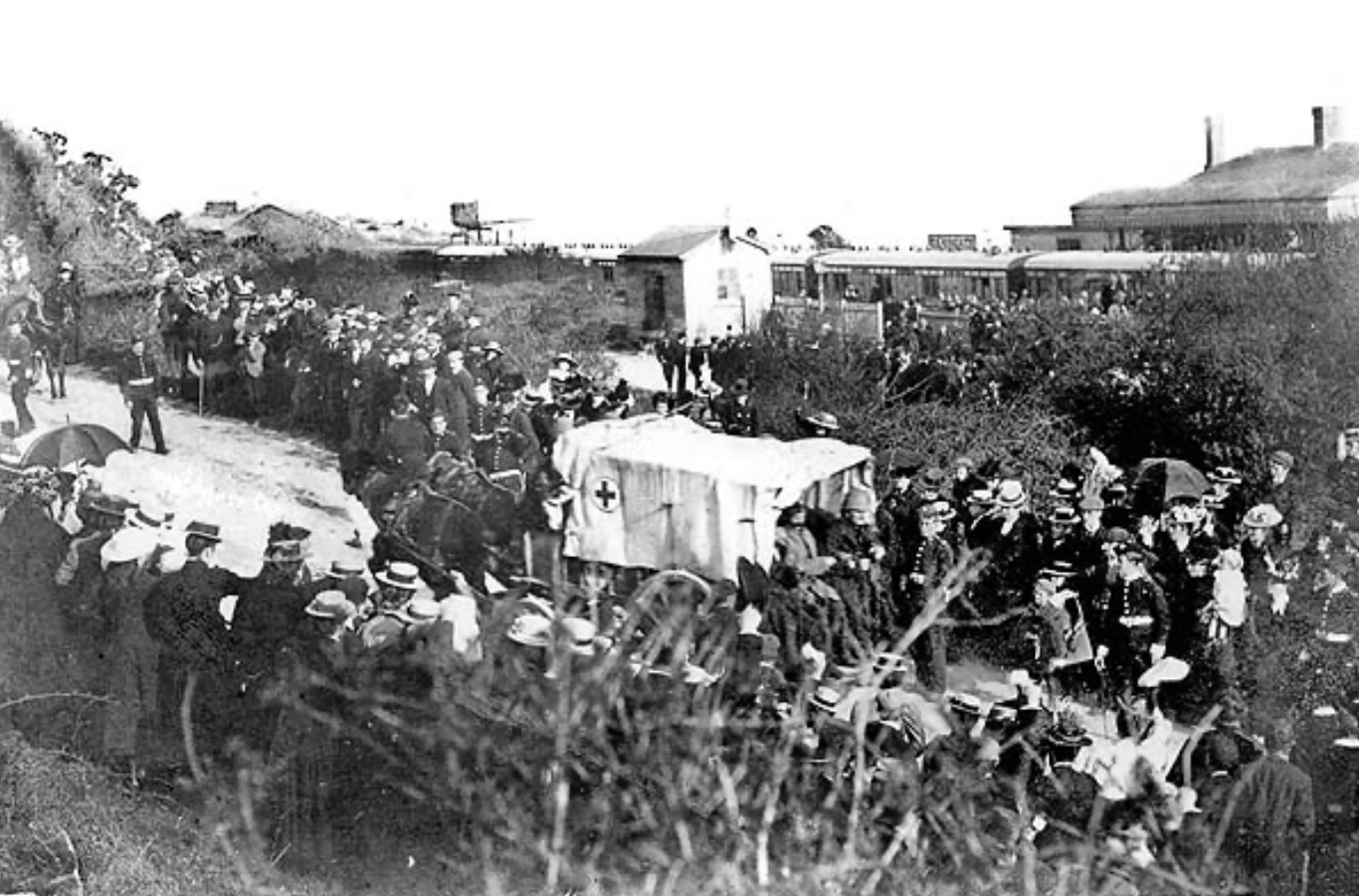
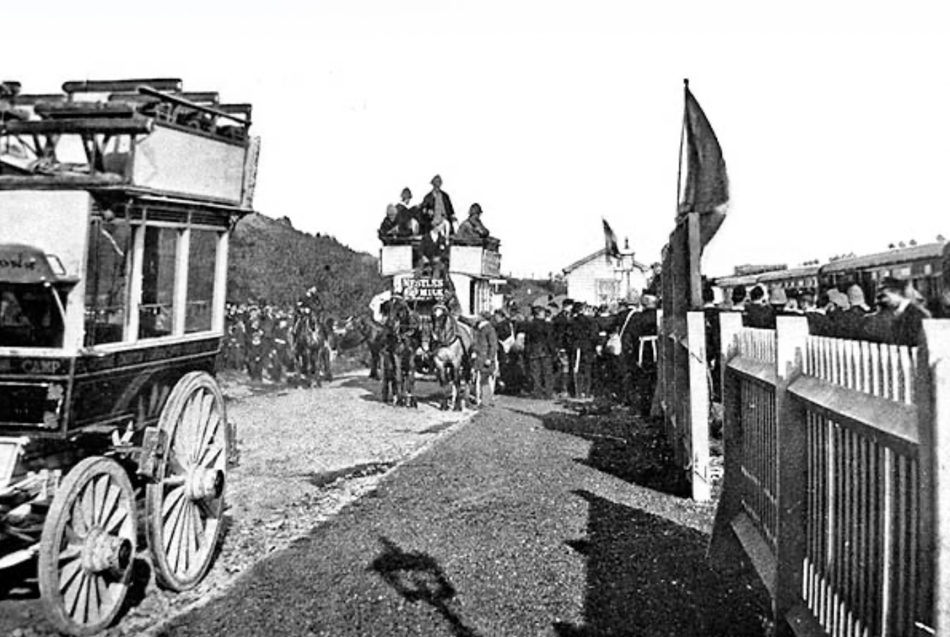
Photograph depicting wounded soldiers being transported through Seabrook following their return from the Boer War, accompanied by a large crowd of local residents gathered to witness their arrival. A horse-drawn ambulance bearing a Red Cross flag is visible at the centre of the procession, highlighting the medical care provided to the injured. The image reflects both the impact of the war on the community and the strong public response to the return of servicemen.
Walking Wounded Transported
Photograph showing a busy arrival scene at Sandgate Station, then located within Seabrook, with a horse-drawn omnibus waiting outside the platform as passengers disembark from a train. A large crowd gathers along the fence line to observe the activity, while luggage and transport vehicles indicate the movement of visitors and residents through this important coastal railway stop. The image captures the station's role as a key gateway to Seabrook and the surrounding area during the early twentieth century. Held in the on-site archives.
The tram along Princess Parade
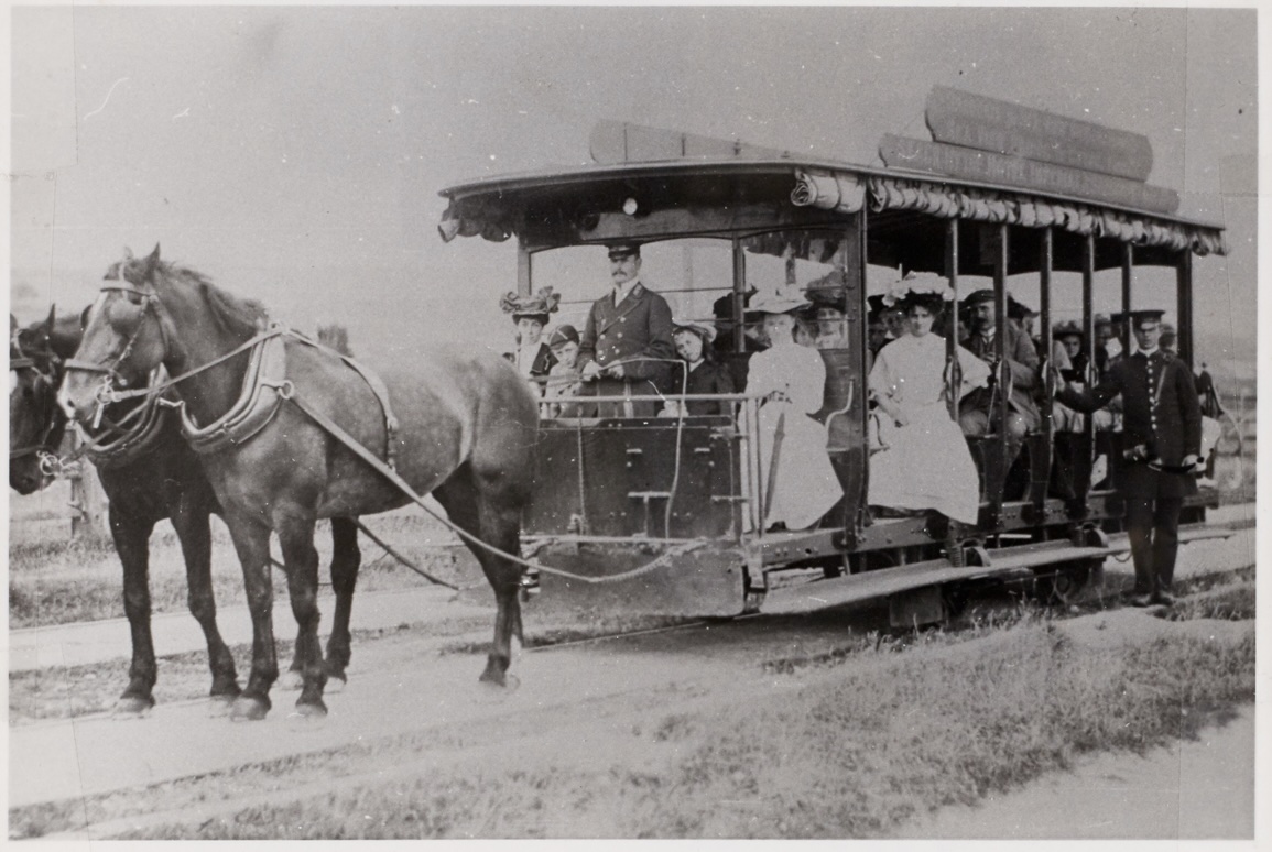
Photograph showing a horse-drawn tram operating along Prince's Parade in Seabrook, with passengers seated inside the open-sided carriage and a uniformed conductor standing at the rear. The tram, pulled by a pair of horses along the coastal route, provided an early form of public transport connecting Seabrook with neighbouring areas. The image captures both the social character of seaside travel and the transitional period before the introduction of motorised transport.
Folkestone to Hythe via Seabrook
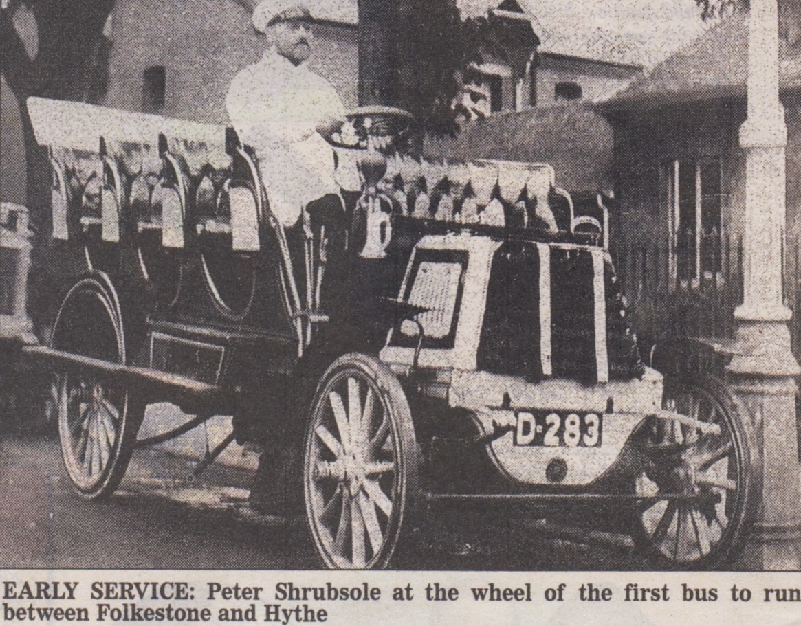
Photograph showing one of the earliest motor bus services operating between Folkestone and Hythe, passing through Seabrook, with driver Peter Shrubsole seated at the wheel. The vehicle, an open-topped motor bus with distinctive early registration markings, represents the transition from horse-drawn transport to motorised travel along the coastal route. This service formed an important development in local transport, improving connections between the seaside communities.
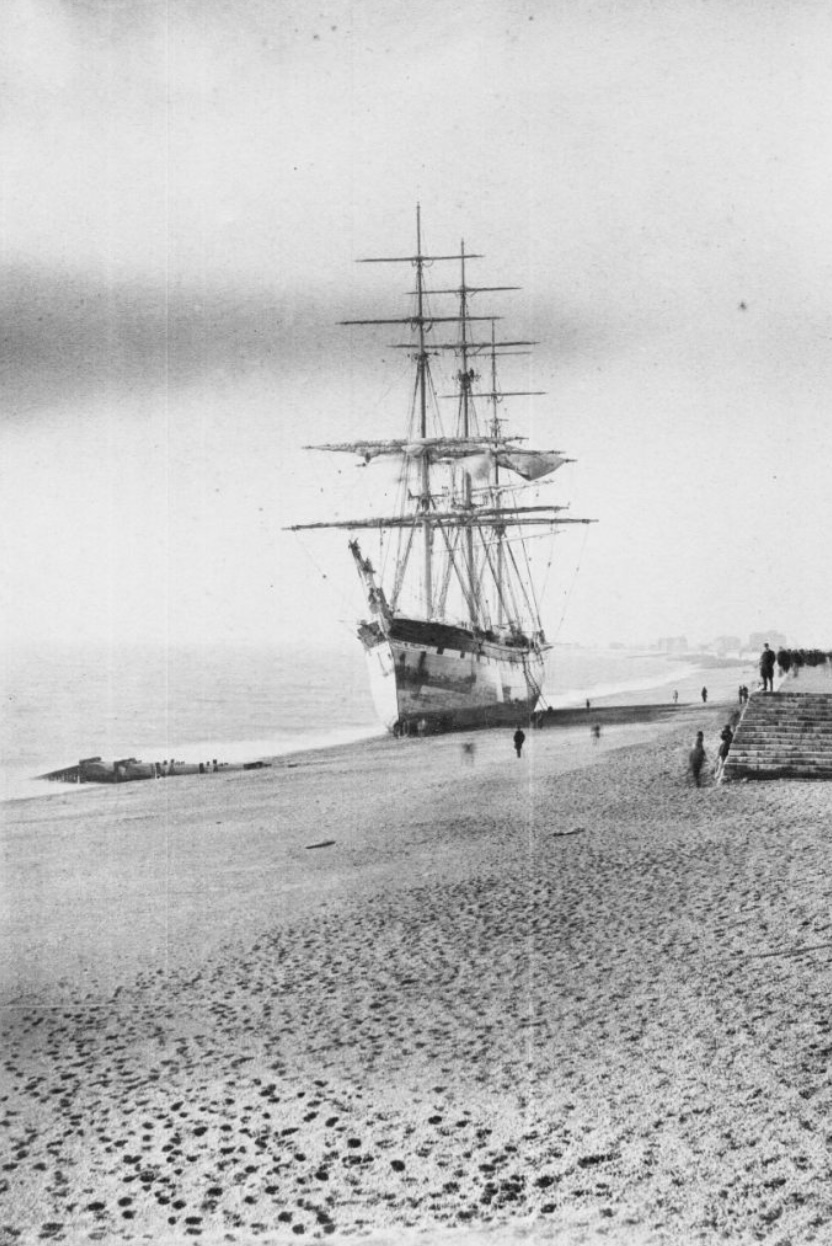
The Benvenue Shipwreck
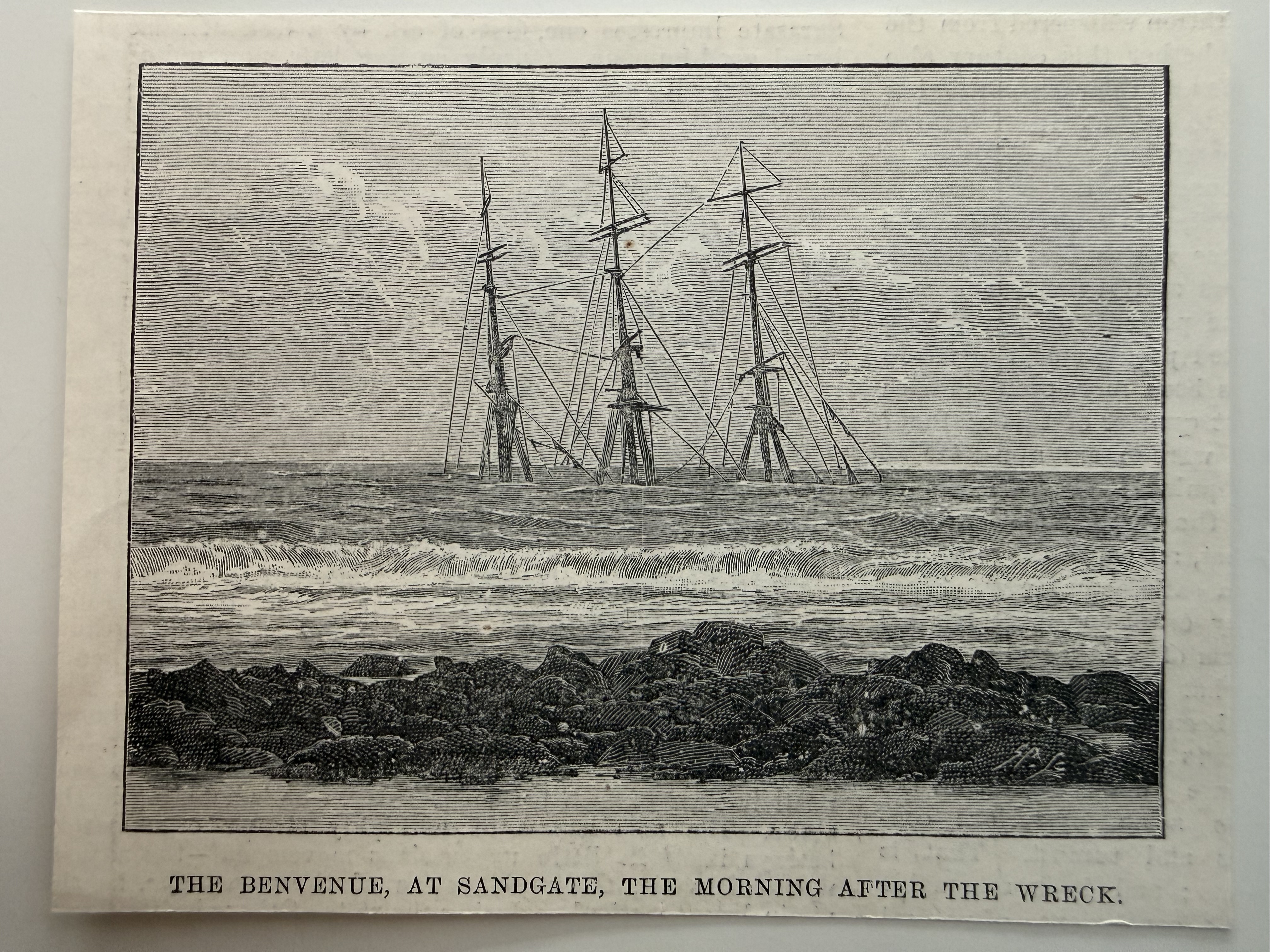
Illustrated print showing the wreck of the Benvenue off Sandgate, the morning after the disaster in 1891. The image captures the stranded vessel just offshore, marking one of the most notable shipwrecks along this stretch of coastline. Held in the on-site archives.
Survivors of the Benvenue Shipwreck, Sandgate (1891)
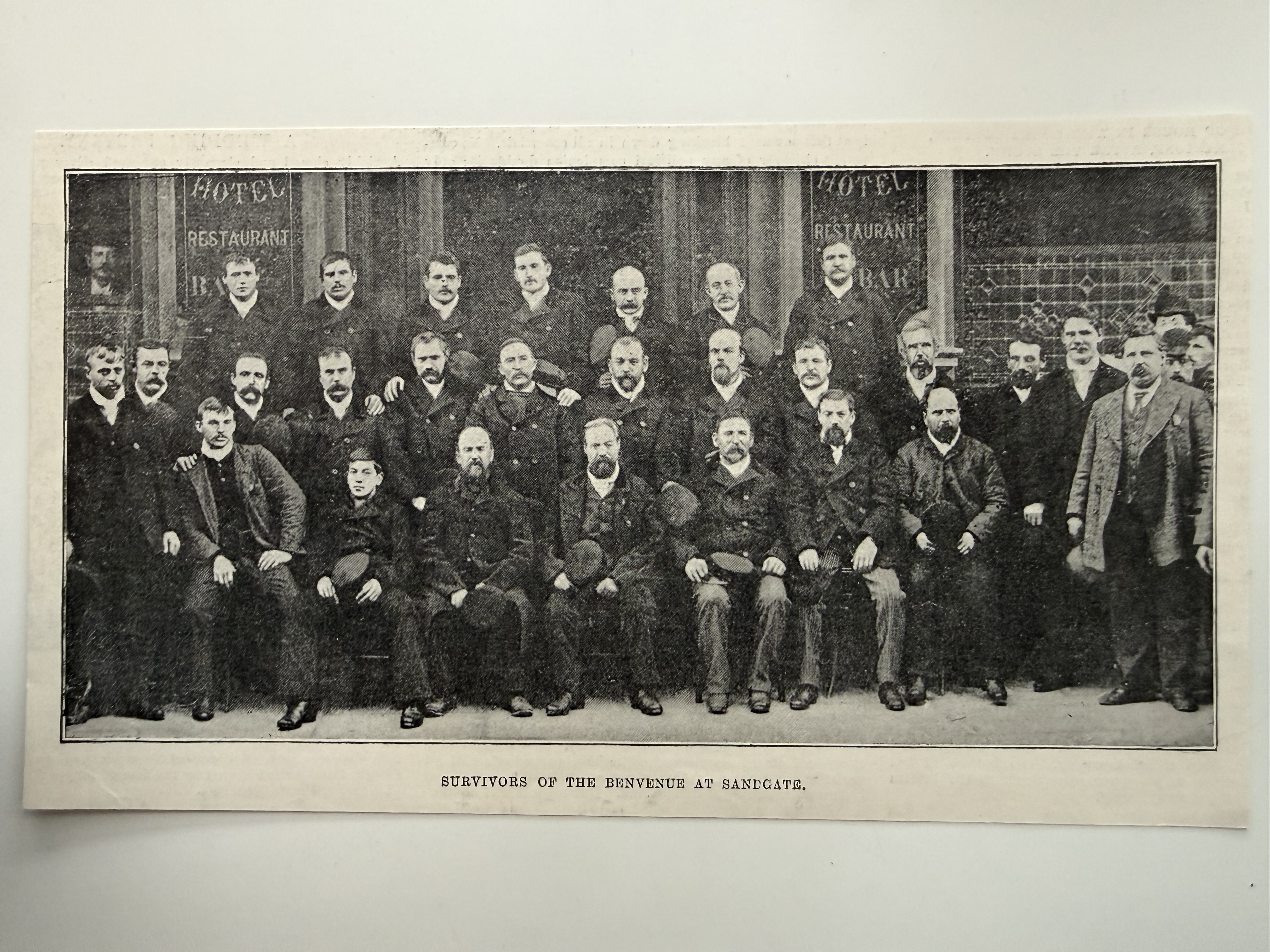
Group photograph of survivors of the Benvenue, wrecked off Sandgate in 1891. The image captures members of the crew following their rescue, marking a notable maritime event along the local coastline. Held in the on-site archives.
The Plassey Wreck, Seabrook. 19 November 1830
Photograph showing the wreck of the Plassey, which occurred on 19 November 1830 off the coast of Seabrook. The image captures the dramatic scene of the shipwreck, highlighting the perilous nature of maritime travel during the early nineteenth century.
Dutch Mail Plane Crash 21 June 1926
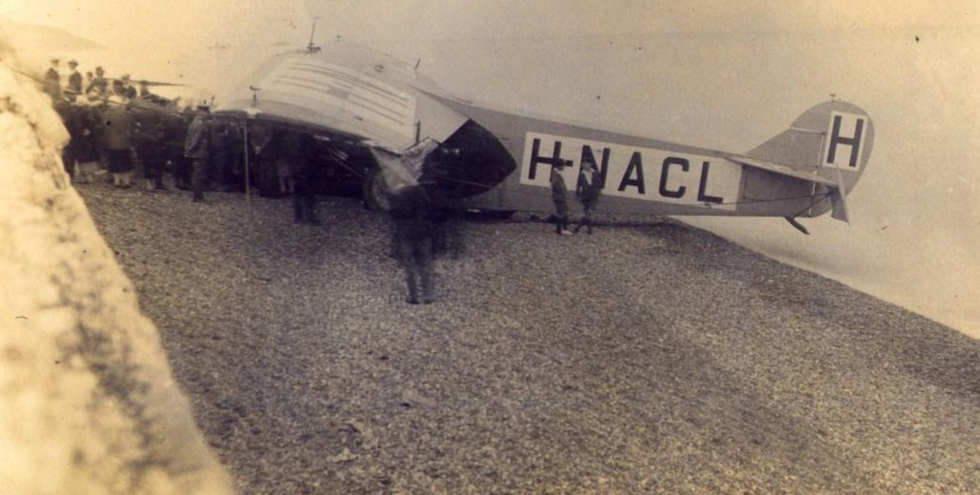
This photograph shows a damaged aircraft marked "H-NACL" resting on the shingle beach at Seabrook, with onlookers gathered nearby. The scene suggests an emergency landing or crash, attracting local attention during a time when aviation was still relatively new.
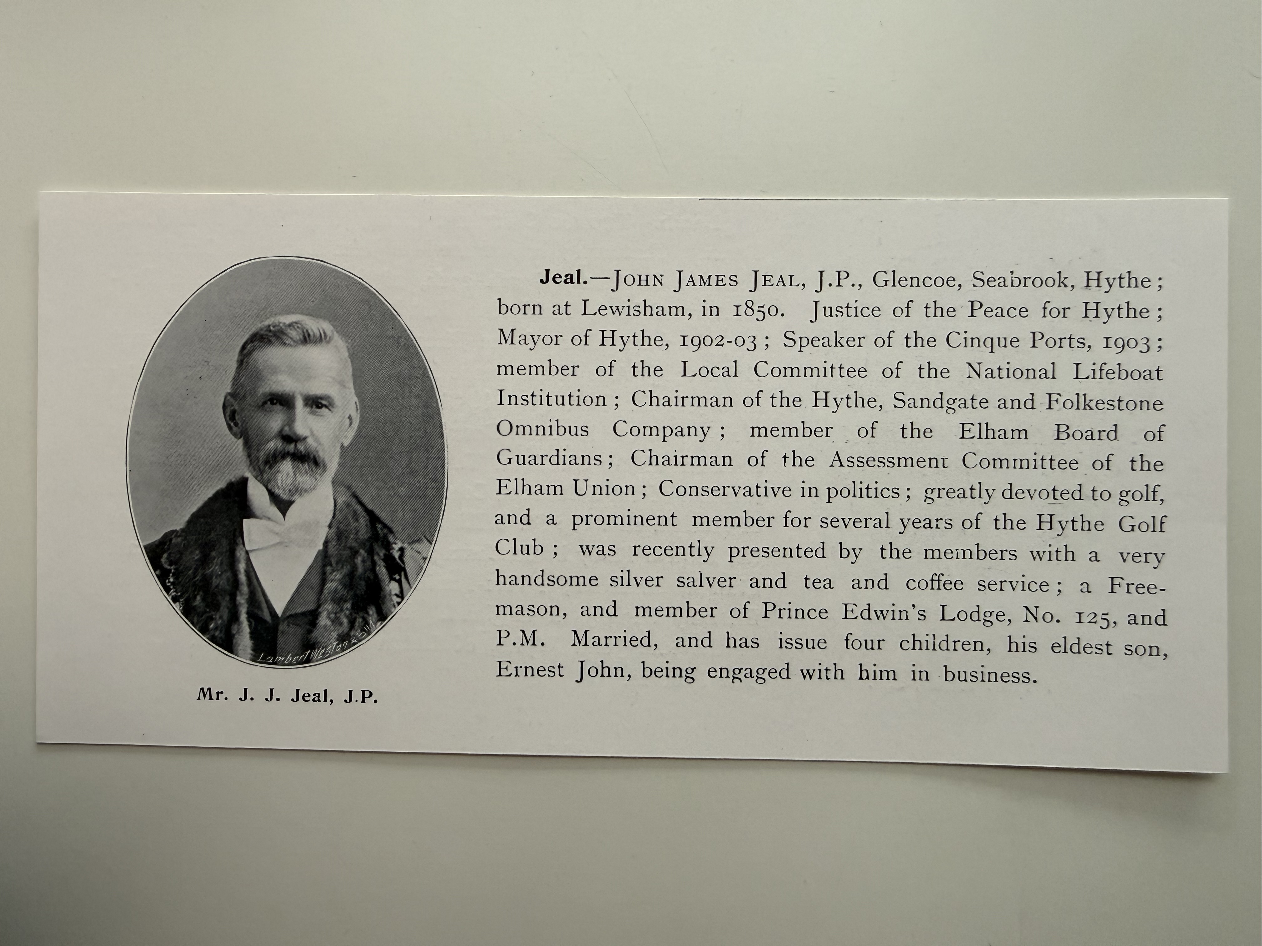
J. J. Jeal, J.P., Seabrook (1904)
Extracted text:
Jeal. JOHN JAMES JEAL, J.P., Glencoe, Seabrook, Hythe; born at Lewisham, in 1850. Justice of the Peace for Hythe; Mayor of Hythe, 1902–03; Speaker of the Cinque Ports, 1903; member of the Local Committee of the National Lifeboat Institution; Chairman of the Hythe, Sandgate and Folkestone Omnibus Company; member of the Elham Board of Guardians; Chairman of the Assessment Committee of the Elham Union; Conservative in politics; greatly devoted to golf, and a prominent member for several years of the Hythe Golf Club; was recently presented by the members with a very handsome silver salver and tea and coffee service; a Freemason, and member of Prince Edwin's Lodge, No. 125, and P.M. Married, and has issue four children, his eldest son, Ernest John, being engaged with him in business.
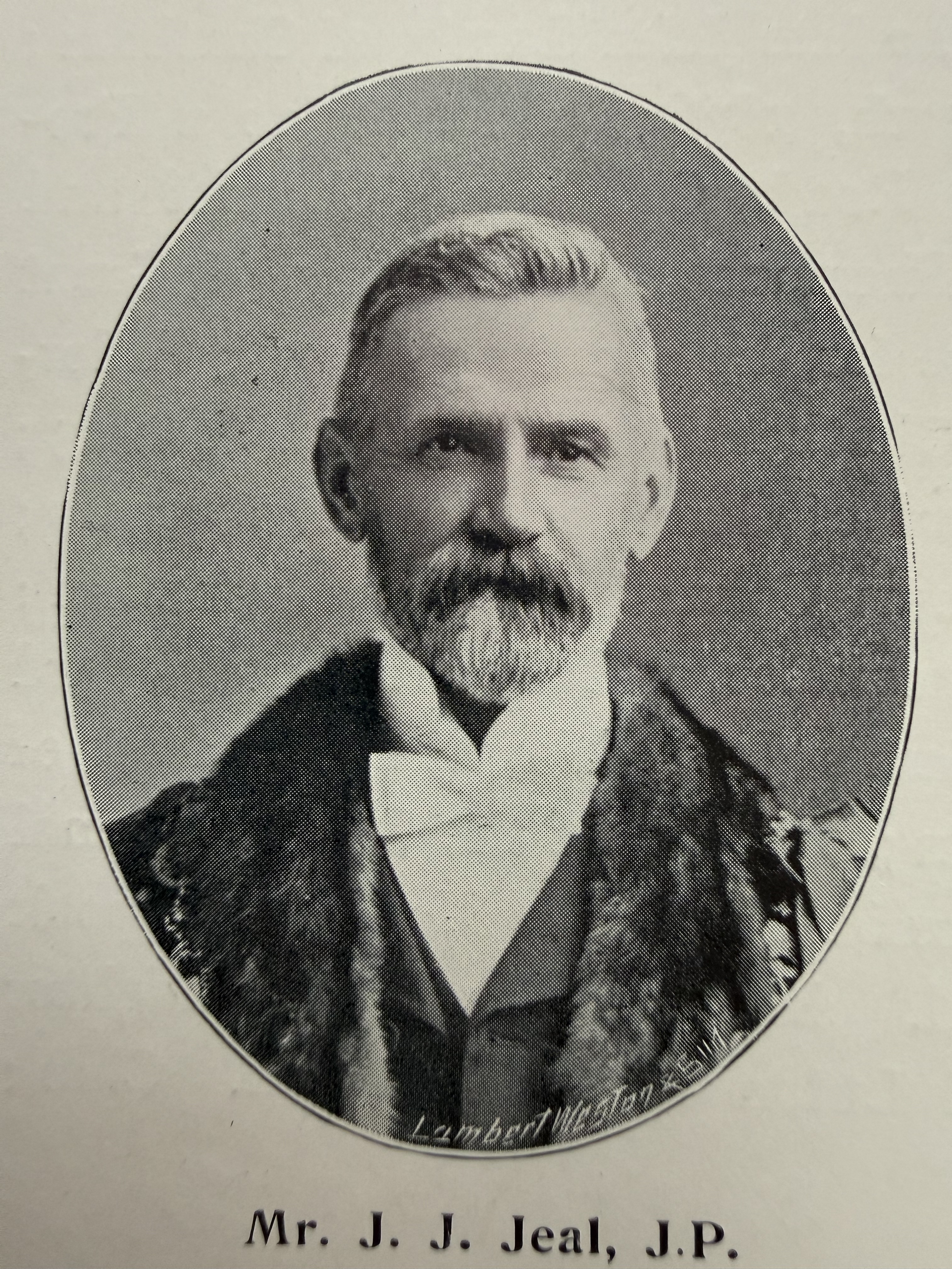
Printed biographical cutting from 1904 featuring John James Jeal of Glencoe, Seabrook. A prominent local figure, he served as Mayor of Hythe (1902–03) and was active in civic, business, and community life. Held in the on-site archives.
Jocelyn Brooke
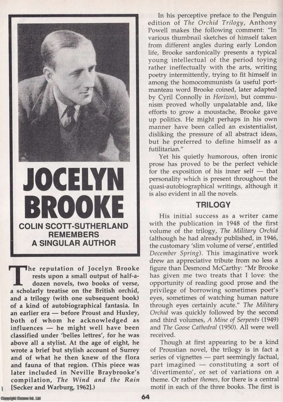
Extract from Colin Scott-Sutherland, Jocelyn Brooke: Remembering a Singular Author, published in The Book & Magazine Collector, 1998.
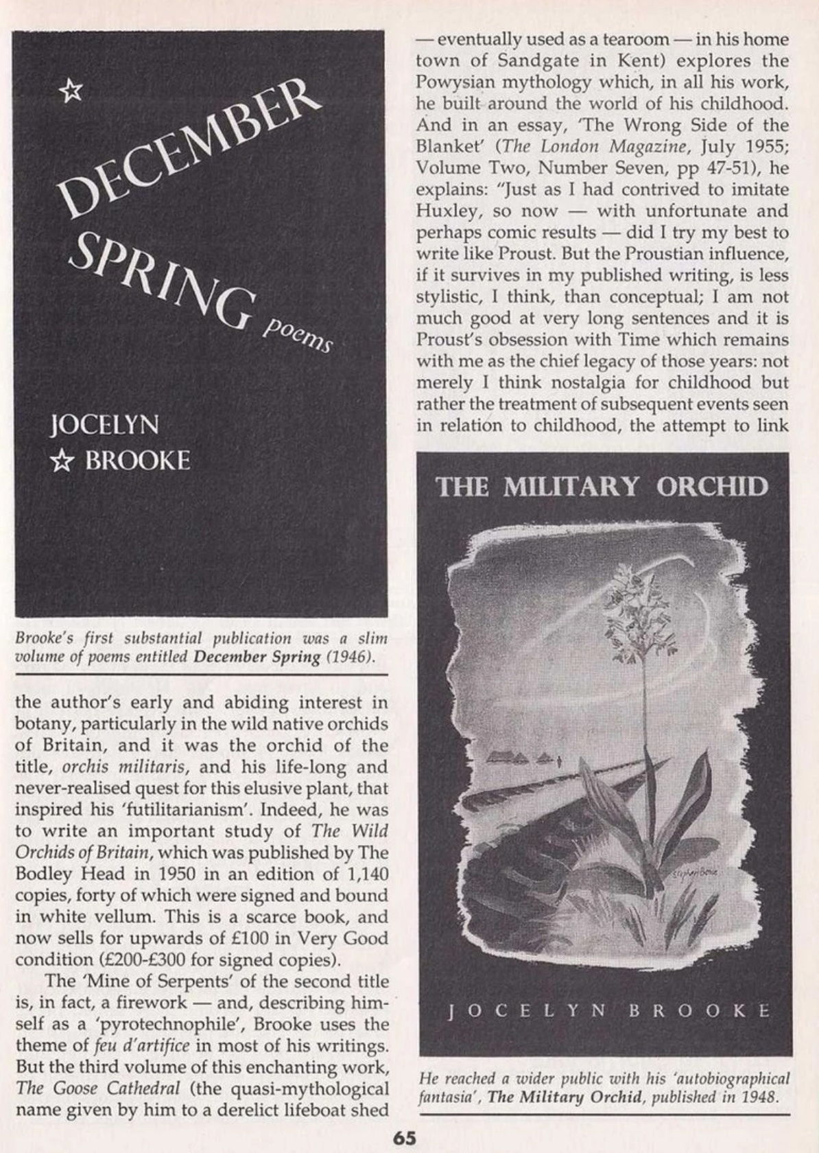
Though at first appearing to be a kind of Proustian novel, the trilogy is in fact a series of vignettes — part seemingly factual, part imagined — constituting a sort of 'divertimento', or set of variations on a theme. Or rather themes, for there is a central motif in each of the three books. The first is the author's early and abiding interest in botany, particularly in the wild native orchids of Britain, and it was the orchid of the title, orchis militaris, and his life-long and never-realised quest for this elusive plant, that inspired his 'futilitarianism'. Indeed, he was to write an important study of The Wild Orchids of Britain, which was published by The Bodley Head in 1950 in an edition of 1,140 copies, forty of which were signed and bound in white vellum. This is a scarce book, and now sells for upwards of £100 in Very Good condition (£200-£300 for signed copies).
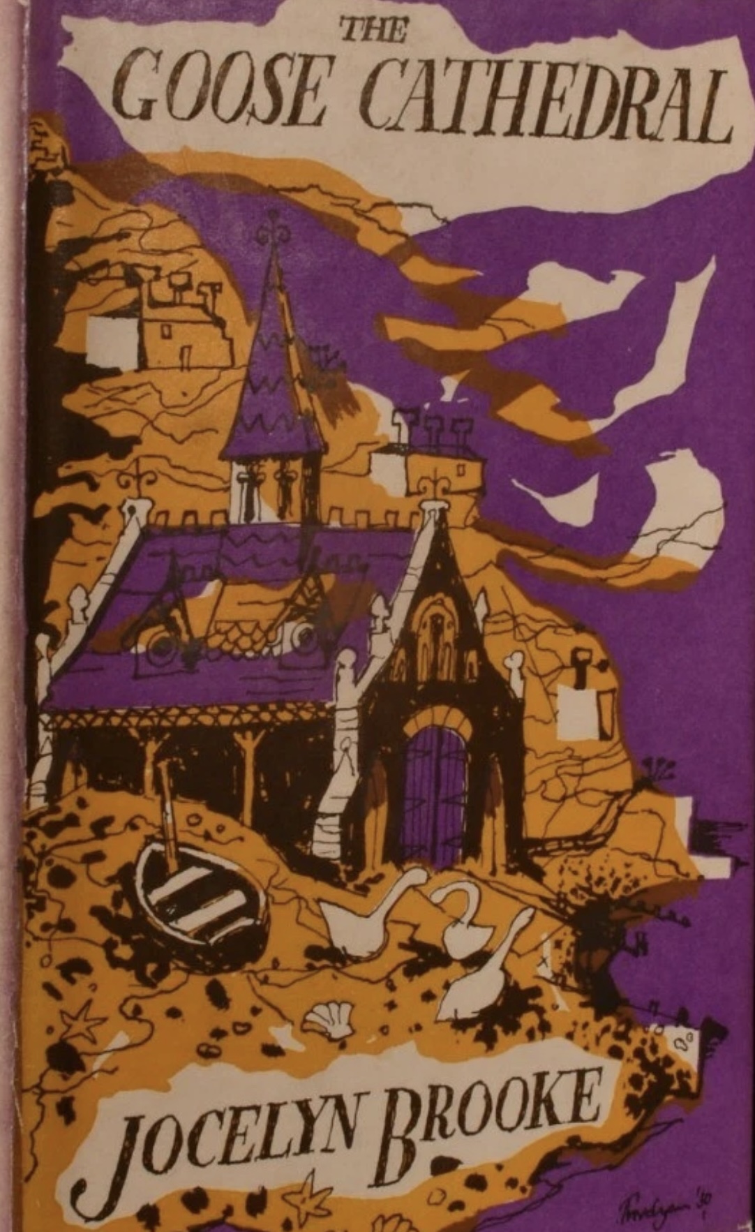
The 'Mine of Serpents' of the second title is, in fact, a firework and, describing himself as a 'pyrotechnophile', Brooke uses the theme of feu d'artifice in most of his writings. But the third volume of this enchanting work, The Goose Cathedral (the quasi-mythological name given by him to a derelict lifeboat shed eventually used as a tearoom — in his home town of Sandgate in Kent) explores the Powysian mythology which, in all his work, he built around the world of his childhood.
The Goose Cathedral by Jocelyn Brooke
Noel Reddings Mother with a signed picture of Jimi Hendrix 1968
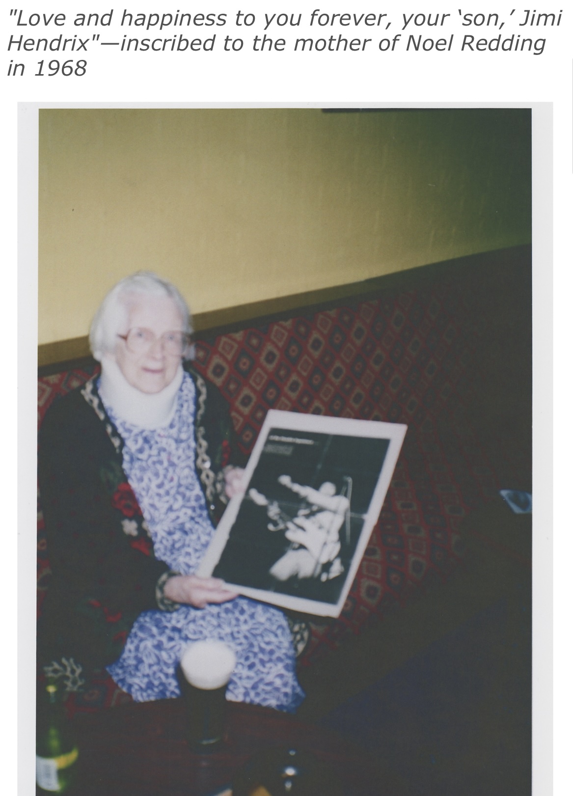
Photograph showing Noel Redding's mother seated and holding a signed photograph of Jimi Hendrix, inscribed in 1968 with the message, "Love and happiness to you forever, your 'son,' Jimi Hendrix." The image reflects the close personal connection between Hendrix and the family of Noel Redding, bassist of The Jimi Hendrix Experience, during the height of their international success. As a rare and personal piece of music history, the photograph illustrates the link between global cultural figures and the local Seabrook and Folkestone community.
Seabrook Hotel now The Imperial Hythe
Extracted text:
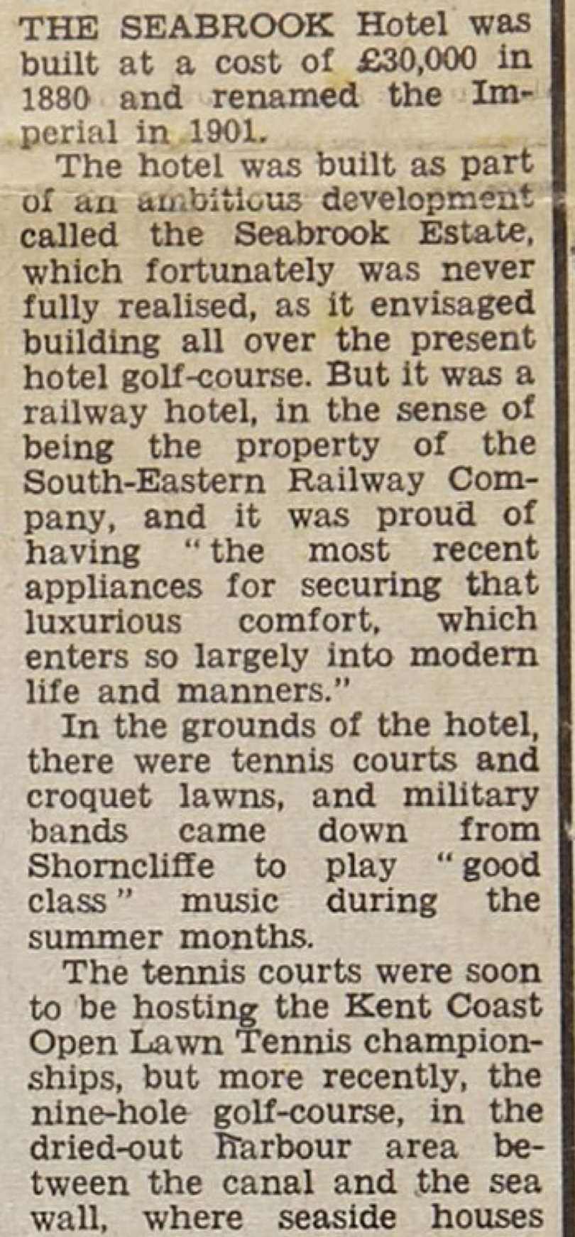
THE SEABROOK Hotel was built at a cost of £30,000 in 1880 and renamed the Imperial in 1901.
The hotel was built as part of an ambitious development called the Seabrook Estate, which fortunately was never fully realised, as it envisaged building all over the present hotel golf-course. But it was a railway hotel, in the sense of being the property of the South-Eastern Railway Company, and it was proud of having "the most recent appliances for securing that luxurious comfort, which enters so largely into modern life and manners."
In the grounds of the hotel, there were tennis courts and croquet lawns, and military bands came down from Shorncliffe to play "good class" music during the summer months.
The tennis courts were soon to be hosting the Kent Coast Open Lawn Tennis championships, but more recently, the nine-hole golf-course, in the dried-out harbour area between the canal and the sea wall, where seaside houses